Borås Municipality
Municipality in Västra Götaland, Sweden
Municipality in Västra Götaland County, Sweden
Borås Municipality Borås kommun | |
|---|---|
Municipality | |
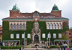 Borås Town Hall | |
 Coat of arms | |
 | |
| Coordinates: 57°43′N 12°56′E / 57.717°N 12.933°E / 57.717; 12.933 | |
| Country | Sweden |
| County | Västra Götaland County |
| Seat | Borås |
| Area | |
| • Total | 967.54 km2 (373.57 sq mi) |
| • Land | 909.9 km2 (351.3 sq mi) |
| • Water | 57.64 km2 (22.25 sq mi) |
| Area as of 1 January 2014. | |
| Population (31 December 2023)[2] | |
| • Total | 114,592 |
| • Density | 120/km2 (310/sq mi) |
| Time zone | UTC+1 (CET) |
| • Summer (DST) | UTC+2 (CEST) |
| ISO 3166 code | SE |
| Province | Västergötland |
| Municipal code | 1490 |
| Website | www.boras.se |
Borås Municipality (Borås kommun) is a municipality in Västra Götaland County in western Sweden. Its seat is located in the city of Borås.
In 1971 the City of Borås was made a municipality (kommun) when the unitary type of local government unit was introduced in Sweden. Three years later many surrounding municipalities were amalgamated with Borås. In 1995 the western part was separated, creating Bollebygd Municipality.
In the 1990s the municipal assembly (kommunfullmäktige) decided to use the name ″Borås stad″ or ″City of Borås″ whenever possible, for the whole municipality, including rural areas. This decision is purely nominal and has no effect on the legal status of the municipality.
Localities
Demographics
This is a demographic table based on Borås Municipality's electoral districts in the 2022 Swedish general election sourced from SVT's election platform, in turn taken from SCB official statistics.[3]
In total there were 113,940 residents, including 83,786 Swedish citizens of voting age.[3] 46.2% voted for the left coalition and 52.1% for the right coalition. Indicators are in percentage points except population totals and income.
| Location | Residents | Citizen adults | Left vote | Right vote | Employed | Swedish parents | Foreign heritage | Income SEK | Degree |
|---|---|---|---|---|---|---|---|---|---|
| % | % | ||||||||
| Alideberg-Erikslund | 1,094 | 786 | 54.1 | 44.2 | 75 | 40 | 60 | 22,412 | 41 |
| Aplared | 1,127 | 909 | 40.6 | 58.7 | 85 | 87 | 13 | 26,582 | 33 |
| Bergdalen S | 1,478 | 1,188 | 39.6 | 59.7 | 87 | 87 | 13 | 29,681 | 51 |
| Bergdalen-Liljeberget | 899 | 667 | 50.1 | 49.4 | 80 | 72 | 28 | 25,419 | 43 |
| Bergsbo-Trandared | 782 | 623 | 38.5 | 59.4 | 81 | 78 | 22 | 25,157 | 42 |
| Bergsäter-Bergsbo | 851 | 921 | 39.6 | 58.2 | 80 | 80 | 20 | 25,170 | 44 |
| Boda-Brämhult | 1,412 | 1,068 | 47.8 | 51.0 | 77 | 50 | 50 | 24,760 | 42 |
| Borgstena-Tämta | 1,385 | 1,082 | 38.9 | 59.6 | 85 | 87 | 13 | 25,352 | 50 |
| Bosnäs-Viared | 1,030 | 793 | 38.2 | 61.0 | 85 | 83 | 17 | 28,392 | 38 |
| Bredared | 1,270 | 972 | 40.9 | 58.5 | 89 | 90 | 10 | 29,782 | 39 |
| Brotorp | 1,386 | 1,112 | 49.4 | 49.4 | 83 | 71 | 29 | 27,154 | 42 |
| Brämhult-Kärra | 1,877 | 1,333 | 43.6 | 55.5 | 87 | 74 | 26 | 30,595 | 53 |
| Brämhult-Ön | 1,535 | 1,144 | 42.3 | 57.0 | 87 | 76 | 24 | 29,955 | 50 |
| Byttorp | 1,462 | 1,268 | 49.3 | 49.1 | 81 | 79 | 21 | 24,668 | 46 |
| Centrum | 641 | 514 | 36.3 | 63.4 | 84 | 74 | 26 | 28,144 | 47 |
| Centrum N | 1,223 | 1,026 | 41.8 | 57.0 | 77 | 71 | 29 | 22,993 | 48 |
| Centrum Ö | 1,448 | 1,234 | 38.8 | 60.0 | 79 | 71 | 29 | 24,787 | 42 |
| Dalsjöfors V | 2,371 | 1,729 | 45.8 | 53.8 | 87 | 83 | 17 | 27,526 | 38 |
| Dalsjöfors Ö | 2,103 | 1,498 | 42.2 | 56.4 | 86 | 86 | 14 | 27,406 | 37 |
| Dammsvedjan-Gässlösa | 1,702 | 1,302 | 48.5 | 50.4 | 85 | 72 | 28 | 27,100 | 47 |
| Dannike | 1,049 | 773 | 38.1 | 60.6 | 83 | 87 | 13 | 27,002 | 29 |
| Druvefors V | 1,368 | 1,121 | 46.3 | 51.2 | 79 | 67 | 33 | 27,642 | 47 |
| Druvefors Ö | 1,068 | 793 | 50.3 | 48.2 | 83 | 63 | 37 | 26,329 | 43 |
| Ekås-Hestra | 1,387 | 1,019 | 45.6 | 53.1 | 87 | 85 | 15 | 31,485 | 47 |
| Fristad-Asklanda | 1,513 | 1,065 | 37.8 | 61.3 | 90 | 87 | 13 | 30,783 | 44 |
| Fristad-Gingri | 1,730 | 1,358 | 46.1 | 52.2 | 83 | 86 | 14 | 22,983 | 30 |
| Fristad-Kvarbo | 1,805 | 1,427 | 42.4 | 56.1 | 83 | 85 | 15 | 25,749 | 35 |
| Frufällan-Tosseryd | 1,355 | 994 | 34.9 | 64.6 | 86 | 77 | 23 | 31,251 | 42 |
| Gånghester | 1,788 | 1,294 | 43.8 | 55.1 | 89 | 82 | 18 | 29,392 | 44 |
| Göta | 1,271 | 967 | 54.2 | 42.1 | 71 | 50 | 50 | 21,417 | 33 |
| Göta-Kristineberg | 1,456 | 1,028 | 54.1 | 41.5 | 71 | 53 | 47 | 23,000 | 38 |
| Göta-Regementet | 893 | 886 | 45.4 | 53.0 | 77 | 75 | 25 | 25,558 | 36 |
| Hedvigsborg-Kråkered | 2,087 | 1,515 | 44.1 | 54.3 | 81 | 74 | 26 | 26,222 | 40 |
| Hestra-Byttorp | 1,455 | 1,137 | 45.4 | 53.3 | 81 | 77 | 23 | 25,865 | 49 |
| Hestra Parkstad | 1,453 | 1,065 | 52.0 | 47.4 | 86 | 79 | 21 | 30,559 | 59 |
| Hulta V | 1,702 | 1,253 | 54.7 | 42.0 | 75 | 49 | 51 | 22,658 | 36 |
| Hulta Ö | 2,017 | 1,129 | 69.7 | 24.5 | 65 | 14 | 86 | 17,946 | 26 |
| Hässleholmen-Bråhult | 1,493 | 1,096 | 49.1 | 49.5 | 83 | 63 | 37 | 27,817 | 52 |
| Hässleholmen-Distansg. | 2,060 | 788 | 74.2 | 22.1 | 56 | 13 | 87 | 15,022 | 33 |
| Hässleholmen-Tunnlandsg. | 2,074 | 956 | 72.2 | 20.4 | 59 | 16 | 84 | 15,138 | 26 |
| Hässleholmen-Våglängdsg. | 1,599 | 848 | 75.6 | 16.8 | 55 | 14 | 86 | 13,132 | 23 |
| Knalleland-Lundby | 705 | 508 | 50.9 | 48.8 | 64 | 55 | 45 | 16,649 | 45 |
| Kristineberg | 1,654 | 1,012 | 58.7 | 37.9 | 68 | 34 | 66 | 18,979 | 35 |
| Lugnet | 1,301 | 1,142 | 47.7 | 51.6 | 78 | 75 | 25 | 23,482 | 47 |
| Lundaskog-Lyckebo | 1,354 | 959 | 37.9 | 61.2 | 88 | 74 | 26 | 33,019 | 48 |
| Målsryd | 1,172 | 901 | 43.8 | 55.1 | 84 | 81 | 19 | 27,086 | 34 |
| Norrby-Billdalsgatan | 1,797 | 872 | 76.6 | 11.5 | 55 | 8 | 92 | 13,481 | 20 |
| Norrby N | 1,187 | 820 | 74.9 | 18.9 | 58 | 15 | 85 | 15,892 | 25 |
| Norrby S | 1,280 | 708 | 67.7 | 26.1 | 62 | 22 | 78 | 15,443 | 32 |
| Norrmalm-Hornsgatan | 1,259 | 1,040 | 42.5 | 56.1 | 83 | 79 | 21 | 27,398 | 44 |
| Norrmalm-Kype | 1,199 | 956 | 49.8 | 48.7 | 80 | 69 | 31 | 24,272 | 46 |
| Norrmalm-Nedre | 1,330 | 1,125 | 46.9 | 51.5 | 83 | 78 | 22 | 26,589 | 48 |
| Norrmalm-Sagavallen | 1,240 | 914 | 50.3 | 46.9 | 83 | 75 | 25 | 27,173 | 45 |
| Parkstaden-Byttorp | 1,240 | 954 | 38.5 | 60.3 | 81 | 80 | 20 | 27,976 | 44 |
| Rydboholm | 1,166 | 857 | 43.4 | 54.6 | 84 | 74 | 26 | 26,446 | 31 |
| Salängen-Villastaden | 1,429 | 1,174 | 39.8 | 58.9 | 81 | 78 | 22 | 28,112 | 47 |
| Sandared | 1,451 | 1,086 | 45.5 | 53.4 | 85 | 85 | 15 | 24,865 | 42 |
| Sandared V | 1,211 | 881 | 38.8 | 60.7 | 88 | 86 | 14 | 31,085 | 49 |
| Sandared Ö | 1,193 | 858 | 31.9 | 67.3 | 89 | 88 | 12 | 32,353 | 53 |
| Sandhult-Hedared | 1,593 | 1,186 | 37.2 | 61.9 | 87 | 84 | 16 | 27,438 | 35 |
| Sjöbo-Almenäs | 1,194 | 976 | 51.3 | 45.0 | 73 | 57 | 43 | 22,386 | 37 |
| Sjöbo-Björksäter | 1,131 | 921 | 51.9 | 45.9 | 72 | 52 | 48 | 20,897 | 33 |
| Sjöbo-Johannelund | 1,069 | 760 | 52.1 | 43.8 | 69 | 47 | 53 | 19,333 | 28 |
| Sjöbo-Långesten | 1,526 | 1,019 | 50.5 | 47.4 | 70 | 42 | 58 | 21,250 | 34 |
| Sjöbo-Nolhaga | 1,139 | 845 | 58.0 | 39.4 | 64 | 45 | 55 | 17,446 | 29 |
| Sjöbo-Ryda | 1,345 | 1,052 | 55.2 | 43.6 | 71 | 56 | 44 | 19,437 | 33 |
| Sjömarken N | 1,466 | 1,018 | 35.3 | 64.5 | 89 | 84 | 16 | 32,979 | 52 |
| Sjömarken S | 1,672 | 1,155 | 40.1 | 59.5 | 86 | 80 | 20 | 31,017 | 50 |
| Sparsör | 1,762 | 1,283 | 39.0 | 59.9 | 89 | 86 | 14 | 31,193 | 51 |
| Svaneholm-Seglora | 1,700 | 1,218 | 45.0 | 52.8 | 79 | 72 | 28 | 24,465 | 30 |
| Svensgärde-Sörmarken | 1,742 | 1,318 | 47.7 | 51.4 | 88 | 69 | 31 | 29,018 | 50 |
| Trandared S | 1,361 | 1,046 | 50.2 | 48.6 | 77 | 69 | 31 | 23,099 | 36 |
| Trandared V | 1,533 | 1,180 | 45.7 | 52.6 | 82 | 73 | 27 | 26,532 | 37 |
| Trandared Ö | 1,328 | 1,093 | 55.0 | 42.9 | 82 | 71 | 29 | 25,678 | 37 |
| Tullen | 1,502 | 1,204 | 48.4 | 50.5 | 77 | 71 | 29 | 22,762 | 34 |
| Villastaden | 1,115 | 1,004 | 38.8 | 60.3 | 83 | 79 | 21 | 28,255 | 42 |
| Viskafors-Fagersberg | 1,538 | 1,108 | 50.8 | 48.5 | 84 | 76 | 24 | 25,525 | 33 |
| Viskafors-Kinnarumma | 1,960 | 1,445 | 41.4 | 57.6 | 84 | 79 | 21 | 27,417 | 33 |
| Äspered-Rångedala | 1,824 | 1,354 | 38.9 | 60.1 | 88 | 91 | 9 | 28,476 | 39 |
| Östermalm | 1,573 | 1,153 | 41.2 | 56.9 | 78 | 67 | 33 | 25,472 | 45 |
| Source: SVT[3] | |||||||||
Twin towns – sister cities


References
- ^ "Statistiska centralbyrån, Kommunarealer den 1 januari 2014" (in Swedish). Statistics Sweden. 2014-01-01. Archived from the original (Microsoft Excel) on 2016-09-27. Retrieved 2014-04-18.
- ^ "Folkmängd och befolkningsförändringar - Kvartal 4, 2023" (in Swedish). Statistics Sweden. February 22, 2024. Retrieved February 22, 2024.
- ^ a b c "Valresultat 2022 för Borås i riksdagsvalet" (in Swedish). SVT. 11 September 2022. Retrieved 8 February 2024.
- ^ "Vän- och partnerskapsorter". boras.se (in Swedish). Borås kommun. Retrieved 2022-05-27.
External links
Wikimedia Commons has media related to Borås Municipality.
- Borås Municipality – Official English site
Places adjacent to Borås Municipality | |
|---|---|


- v
- t
- e
Municipalities and seats of Västra Götaland County
- Ale
- Alingsås
- Åmål
- Bengtsfors
- Bollebygd
- Borås
- Dals-Ed
- Essunga
- Falköping
- Färgelanda
- Götene
- Gothenburg
- Grästorp
- Gullspång
- Härryda
- Herrljunga
- Hjo
- Karlsborg
- Kungälv
- Lerum
- Lidköping
- Lilla Edet
- Lysekil
- Mariestad
- Mark
- Mellerud
- Mölndal
- Munkedal
- Öckerö
- Orust
- Partille
- Skara
- Skövde
- Sotenäs
- Stenungsund
- Strömstad
- Svenljunga
- Tanum
- Tibro
- Tidaholm
- Tjörn
- Töreboda
- Tranemo
- Trollhättan
- Uddevalla
- Ulricehamn
- Vänersborg
- Vara
- Vårgårda

- Alingsås
- Åmål
- Bengtsfors
- Bollebygd
- Borås
- Ed
- Falköping
- Färgelanda
- Götene
- Gothenburg
- Grästorp
- Gullspång and Hova
- Henån
- Herrljunga
- Hjo
- Karlsborg
- Kinna
- Kungälv
- Kungshamn
- Lerum
- Lidköping
- Lilla Edet
- Lysekil
- Mariestad
- Mellerud
- Mölndal
- Mölnlycke
- Munkedal
- Nödinge-Nol
- Nossebro
- Öckerö
- Partille
- Skara
- Skärhamn
- Skövde
- Stenungsund
- Strömstad
- Svenljunga
- Tanumshede
- Tibro
- Tidaholm
- Töreboda
- Tranemo
- Trollhättan
- Uddevalla
- Ulricehamn
- Vänersborg
- Vara
- Vårgårda
Authority control databases | |
|---|---|
| International |
|
| National |
|
| Geographic |
|


