San Pascual (Batangas)
| San Pascual (Batangas) | |||
|---|---|---|---|
 | |||
| Land |  Filippinene Filippinene | ||
| Status | kommune | ||
| Grunnlagt | 4. august 1969 | ||
| Oppkalt etter | Pascual Baylón | ||
| Postnummer | 4204 | ||
| Retningsnummer | 43 | ||
| Areal | 50,7 km² | ||
| Befolkning | 69 009[1] (2020) | ||
| Bef.tetthet | 1 361,12 innb./km² | ||
| Antall husholdninger | 17 717 | ||
| Språk | Tagalog | ||
| Høyde o.h. | 46 meter | ||
 San Pascual (Batangas) 13°48′00″N 121°02′00″Ø | |||
San Pascual på Commons | |||
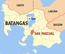
San Pascual (Bayan ng San Pascual) er en kommune på Filippinene. Kommunen ligger på øya Luzon og tilhører provinsen Batangas.
Barangayer
Kommunen er inndelt i 29 barangayer.[2]
- Alalum
- Antipolo
- Balimbing
- Banaba
- Bayanan
- Danglayan
- Del Pilar
- Gelerang Kawayan
- Ilat North
- Ilat South
- Kaingin
- Laurel
- Malaking Pook
- Mataas Na Lupa
- Natunuan North
- Natunuan South
- Padre Castillo
- Palsahingin
- Pila
- Poblacion
- Pook Ni Banal
- Pook Ni Kapitan
- Resplandor
- Sambat
- San Antonio
- San Mariano
- San Mateo
- Santa Elena
- Santo Niño
Referanser
Kilder
- 2015 Census of Population and Housing Report Philippine Statistics Authority


