Weethalle
Town in New South Wales, Australia
33°52′32″S 146°37′30″E / 33.87556°S 146.62500°E / -33.87556; 146.62500- 526 km (327 mi) W of Sydney
- 100 km (62 mi) NE of Griffith
- 57 km (35 mi) W of West Wyalong
Weethalle (/ˈwiːθæli/ WEE-thal-ee) is a town in the Central West region of New South Wales, Australia. The town is in the Bland Shire local government area and on the Mid-Western Highway, 526 kilometres (327 mi) west of the state capital, Sydney, and 100 kilometres (62 mi) north east of Griffith. At the 2011 census, Weethalle and the surrounding area had a population of 307.[1] The name "Weethalle" is said to be an Aboriginal Australian word for drink. Locals refer to the town as the Wee or the Peethalle.[2]
History
The area now known as Weethalle lies on the traditional lands of the Wiradjuri people.[3]
The Weethalle area was set aside as homestead farms for returned soldiers in 1921.[4] The Rankins Springs railway line was extended to Weethalle in 1922.[5] Land clearing commenced and by 1923 the first wheat from the area was delivered to the Weethalle railway station.[6]
By 1924, a site was surveyed for a village to service the surrounding farms with town allotment sales taking place the following year.[7][8] A "skeleton" town was in existence by 1926, with "buildings in all states of construction" and "built mostly of wood".[9] In the same year, a provisional school was established along with a branch of the Commercial Banking Company of Sydney.[10][11]
An observer in 1928 described the growth of Weethalle as "remarkable" with the town having "sprung up in the night".[12] In that year, a new hotel was built at a cost of £13,000. The hotel was the newest addition to a town that also boasted a bank, "2 stores ... butchers, bakers, hairdresser and tobacconist, several agents, a school, a doctor, a dance and picture hall, and a tri-weekly rail service."[12]
Sport
The most popular sport in Weethalle is rugby league. The town's team, the Weethalle Kangaroos, used to compete in the Group 17 Rugby League competition. Nowadays, the town's players play for either West Wyalong or Rankins Springs.
Gallery
-
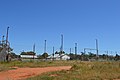
 Weethalle Mid-Western Highway
 -
 Weethalle Mid-Western Highway
 -
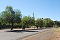
 Pioneer Park
 -
 park
park -
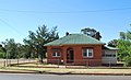
 Court House
 -
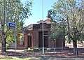
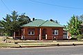
 Post Office
 -
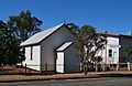 Presbyterian Church
 -
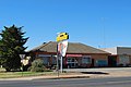 Weethalle Roadhouse
 -
 Weethalle Showgrounds
 -
 Sports Ground
 -
 Tennis Courts
 -
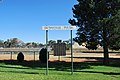
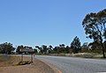 Weethalle Town Entry
 -
 CWA Rooms
 -
 Street in Weethalle
 -
 Weethalle Street
 -
 Museum
 -
 War memorial
 -
 Weethalle Wee St
 -
 Railway Station
 -
 Wheatfield near Weethalle


References
- ^ a b Australian Bureau of Statistics (31 October 2012). "Weethalle (State Suburb)". 2011 Census QuickStats. Retrieved 2 April 2015.

- ^ "Weethalle". Geographical Names Register (GNR) of NSW. Geographical Names Board of New South Wales. Retrieved 14 January 2014.
- ^ Studies, Australian Institute of Aboriginal and Torres Strait Islander (10 January 2021). "Map of Indigenous Australia". aiatsis.gov.au. Retrieved 27 March 2022.
- ^ "ORIGINAL HOMESTEAD FARMS". Narandera Argus and Riverina Advertiser (NSW : 1893 – 1953). NSW: National Library of Australia. 2 August 1921. p. 1. Retrieved 14 January 2014.
- ^ "BARMEDMAN R.S. RAILWAY". The Wyalong Advocate and Mining, Agricultural and Pastoral Gazette (NSW : 1900 – 1928). NSW: National Library of Australia. 28 July 1922. p. 3. Retrieved 14 January 2014.
- ^ "DISTRICT NEWS". Albury Banner and Wodonga Express (NSW : 1896 – 1938). NSW: National Library of Australia. 21 December 1923. p. 25. Retrieved 14 January 2014.
- ^ "WEETHALLE". The Wyalong Advocate and Mining, Agricultural and Pastoral Gazette (NSW : 1900 – 1928). NSW: National Library of Australia. 14 November 1924. p. 4. Retrieved 14 January 2014.
- ^ "WEETHALLE TOWNSHIP". The Wyalong Advocate and Mining, Agricultural and Pastoral Gazette (NSW : 1900 – 1928). NSW: National Library of Australia. 29 September 1925. p. 7. Retrieved 14 January 2014.
- ^ "WEETHALLE NOTES". The Wyalong Advocate and Mining, Agricultural and Pastoral Gazette (NSW : 1900 – 1928). NSW: National Library of Australia. 25 May 1926. p. 5. Retrieved 14 January 2014.
- ^ "WEETHALLE PUBLIC SCHOOL". The Wyalong Advocate and Mining, Agricultural and Pastoral Gazette (NSW : 1900 – 1928). NSW: National Library of Australia. 12 October 1926. p. 6. Retrieved 14 January 2014.
- ^ "BANK OPENED AT WEETHALLE". The Wyalong Advocate and Mining, Agricultural and Pastoral Gazette (NSW : 1900 – 1928). NSW: National Library of Australia. 7 May 1926. p. 1. Retrieved 14 January 2014.
- ^ a b "RISING WEETHALLE". The West Wyalong Advocate (NSW : 1928). NSW: National Library of Australia. 19 October 1928. p. 8. Retrieved 14 January 2014.
Further reading
- Weethalle 75th Celebration Committee (1999), Talk About Weethalle : 75th celebration, 1924–1999, Weethalle 75th Celebration Committee, ISBN 978-0-646-37856-5
{{citation}}: CS1 maint: numeric names: authors list (link)
External links
![]() Media related to Weethalle at Wikimedia Commons
Media related to Weethalle at Wikimedia Commons
- Weethalle - Bland Shire Council
- v
- t
- e
Towns in Bland Shire local government area
Main Article: Local government areas of New South Wales
 | This New South Wales geography article is a stub. You can help Wikipedia by expanding it. |
- v
- t
- e


