Tweng
Place in Salzburg, Austria

Coat of arms
(2018-01-01)[2]
5563
Tweng is a municipality in the district of Tamsweg in the state of Salzburg in Austria.
Geography
Tweng lies in the Lungau on the south side of the Radstädter Tauern.
References
Gallery
-
 between Vorder and Mauterndorf, panorama
 -
 between Vorder and Mauterndorf, panorama
 -
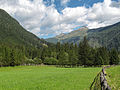
 Vorder, view to the village


- v
- t
- e
Municipalities in the district of Tamsweg
Authority control databases | |
|---|---|
| International |
|
| National |
|
 | This Salzburg state location article is a stub. You can help Wikipedia by expanding it. |
- v
- t
- e


