Tomar do Geru
Municipality in Northeast, Brazil
Tomar do Geru Município de Tomar do Geru | |
|---|---|
Municipality | |
 Flag  Seal | |
| 11°22′22″S 37°50′27″W / 11.37278°S 37.84083°W / -11.37278; -37.84083 | |
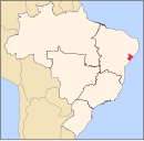
| Country |  Brazil Brazil |
| Region | Northeast |
| State |  Sergipe Sergipe |
| Founded | November 25, 1953 |
| Government | |
| • Mayor | Augusto Soares Diniz |
| Area | |
| • Total | 305 km2 (118 sq mi) |
| Elevation | 170 m (560 ft) |
| Population (2020 [1]) | |
| • Total | 13,535 |
| • Density | 44/km2 (110/sq mi) |
| Demonym | Geruense |
| Time zone | UTC−3 (BRT) |
| Website | tomardogeru |
Tomar do Geru is a municipality located in the Brazilian state of Sergipe. Its population was 13,535 (2020) and it covers 305 km2 (118 sq mi). Tomar do Geru has a population density of 43 inhabitants per square kilometer. It is located 131 km (81 mi) from the state capital of Sergipe, Aracaju. [2] The Church of Nossa Senhora do Socorro was built by the Society of Jesus in 1688. It was listed as a historic structure by the Brazilian National Institute of Historic and Artistic Heritage (IPHAN) in 1943.[3]
References
- ^ IBGE 2020
- ^ "Tomar do Geru" (in Portuguese). Brasília, Brazil: Instituto Brasileiro de Geografia e Estatística. 2016. Retrieved 2016-11-29.
- ^ Dos Santos, Maria Socorro Soares (2011). A igreja Nossa Senhora do Socorro: uma escola à parte (PDF). Anais do 5º Seminário Internacional de Memória e Patrimônio (in Portuguese). Pelotas, Rio Grande do Sul: Programa de Pós-graduação em Memória Social e Patrimônio Cultural, Universidade Federal de Pelotas.
- v
- t
- e
Capital: Aracaju
| Agreste de Itabaiana |
|
|---|---|
| Agreste de Lagarto | |
| Nossa Senhora das Dores | |
| Tobias Barreto |
| Aracaju | |
|---|---|
| Baixo Cotinguiba | |
| Boquim |
|
| Cotinguiba | |
| Estancia | |
| Japaratuba | |
| Propria |
| Carira | |
|---|---|
| Sergipana do Sertao do Sao Francisco |
 | This Sergipe, Brazil location article is a stub. You can help Wikipedia by expanding it. |
- v
- t
- e


