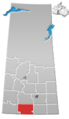
St. Boswells, Saskatchewan
St. Boswells is a hamlet in Glen Bain Rural Municipality No. 105, Saskatchewan, Canada. The hamlet is about 8 km east of Highway 19, and about 25 km northwest of the town of Gravelbourg. Very little remains of the former village except a well known as the best water around, and sidewalks which mark the once prosperous business section of St. Boswells.
History
St. Boswells was a railroad town founded in 1918, as a Canadian National Railway point along the line from Moose Jaw to Neidpath, though the surrounding area had been settled at least a decade earlier. Named after Alex Dow's, hometown of St. Boswells, Roxburghshire, Scotland. St. Boswells was chosen as the name for the community's first post office.
See also
- Scottish place names in Canada
- List of communities in Saskatchewan
- Villages of Saskatchewan
- Hamlets of Saskatchewan
References
- ^ Official website http://www.mds.gov.sk.ca/apps/Pub/MDS/muniDetails.aspx?cat=10&mun=2396 Glen Bain No.
- ^ National Archives, Archivia Net, Post Offices and Postmasters, archived from the original on October 6, 2006, retrieved January 19, 2009
- ^ Government of Saskatchewan, MRD Home, Municipal Directory System, archived from the original on November 21, 2008
- ^ Canadian Textiles Institute. (2005), CTI Determine your provincial constituency, archived from the original on September 11, 2007
- ^ Commissioner of Canada Elections, Chief Electoral Officer of Canada (2005), Elections Canada On-line
- v
- t
- e

communities
| Organized hamlets | |
|---|---|
| Special service areas | |
| Hamlets |
- Arbuthnot
- Billimun
- Bishopric
- Buffalo Gap
- Canopus
- Cardross
- Coppen
- Crystal Hill
- Davyroyd
- Dunkirk
- Elm Springs
- Esme
- Ettington
- Expanse
- Ferland
- Fir Mountain
- Galilee
- Glen Bain
- Glentworth
- Grand Valley
- Gye
- Horse Creek
- Killdeer
- Lisieux
- Little Woody
- Lonesome Butte
- Macworth
- Maxwellton
- Mazenod
- McEachern
- Melaval
- Milly
- Mitchellton
- Palmer
- Quantock
- Readlyn
- Reliance
- Royer
- St. Boswells
- St. Victor
- Strathallen
- Summercove
- Twin Valley
- Verwood
- West Poplar
- Wideview
- Willows
- Willowvale
- Woodrow
50°03′00″N 106°50′02″W / 50.05000°N 106.83389°W / 50.05000; -106.83389
 | This article about a location in the Census Division No. 3 of Saskatchewan is a stub. You can help Wikipedia by expanding it. |
- v
- t
- e


