South Terrace, Adelaide


- 34°56′11″S 138°35′18″E / 34.936285°S 138.588442°E / -34.936285; 138.588442 (West end)
- 34°56′05″S 138°37′04″E / 34.934777°S 138.617781°E / -34.934777; 138.617781 (East end)
Goodwood Road
Anzac Highway
Adelaide
- Morphett Street
- King William Street
- Frome Street
- Pulteney Street
- Unley Road
- Glen Osmond Road
- Hutt Street
Beaumont Road
Adelaide
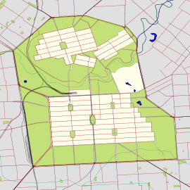
South Terrace is one of the four terraces which bound the city centre of Adelaide, the capital of South Australia.
It is the southern edge of the city centre, and is bounded by the Adelaide parklands to the south, including Veale Gardens and Adelaide Himeji Garden.
South Terrace runs east from the intersection of West Terrace, Anzac Highway and Goodwood Road. Other major intersections are with King William Street/Peacock Road, where the Glenelg tram line crosses, and the intersection of Pulteney Street and Glen Osmond Road.
Adelaide Trades Hall and Pulteney Grammar School are located on South Terrace, as is a large office tower owned by Optus.
See also
 Australian roads portal
References
- ^ Google (30 May 2022). "South Terrace" (Map). Google Maps. Google. Retrieved 30 May 2022.
- v
- t
- e
|
| ||||||||||
 | This article about Adelaide is a stub. You can help Wikipedia by expanding it. |
- v
- t
- e
 | This Australian road or road transport-related article is a stub. You can help Wikipedia by expanding it. |
- v
- t
- e


