Schaijk
Town in North Brabant, Netherlands
51°44′41″N 5°37′51″E / 51.74472°N 5.63083°E / 51.74472; 5.63083 (2021)[1]
5374[1]
Schaijk is a town in the Dutch province of North Brabant. It is located in the former municipality of Landerd, about 8 kilometres (5.0 mi) southeast of Oss.
History
Schaijk developed in the Middle Ages on the border of the sand and clay land.[3] It was part of the Land van Ravenstein [nl] which became a Catholic enclave of Palatinate-Neuburg within the Dutch Republic in 1631.[4] The Land van Ravenstein was conquered by France in 1794, and sold to the Batavian Republic (the predecessor of the Kingdom of the Netherlands) in 1800.[5]
The St Antonius Abt Church was built between 1894 and 1895 to replace the medieval church. Between 1901 and 1902, a new wall was built around the 15th century tower and the tower and enlarged.[3]
Schaijk was home to 536 people in 1840.[6] Schaijk was a separate municipality until 1994, when it merged with Zeeland to form the new municipality of Landerd.[7] Since 2022 it has been part of the new municipality of Maashorst.[6]
Schaijk is known for its carnival, called "moeslands carnaval". During carnival, The name changes from Schaijk to Moesland, which loosely translates into "Kale-land".
Gallery
-
 Former town hall
 -
 School
 -
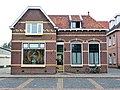 Shop in Schaijk
 -
 Heath near Schaijk


References
- ^ a b c "Kerncijfers wijken en buurten 2021". Central Bureau of Statistics. Retrieved 17 April 2022.
- ^ "Postcodetool for 5374AA". Actueel Hoogtebestand Nederland (in Dutch). Het Waterschapshuis. Retrieved 17 April 2022.
- ^ a b Chris Kolman & Ronald Stenvert (1997). Schaijk (in Dutch). Zwolle: Waanders. ISBN 90 400 9945 6. Retrieved 16 April 2022.
- ^ L.J. Rogier (1947). Geschiedenis van het katholicisme in Noord-Nederland in de 16e en de 17e eeuw (in Dutch). Amsterdam: Urbi et orbi. Retrieved 17 April 2022.
- ^ "Geschiedenis". Vesting Ravenstein (in Dutch). Retrieved 17 April 2022.
- ^ a b "Schaijk". Plaatsengids (in Dutch). Retrieved 17 April 2022.
- ^ Ad van der Meer and Onno Boonstra, Repertorium van Nederlandse gemeenten, KNAW, 2011.
External links
 Media related to Schaijk at Wikimedia Commons
- v
- t
- e
Populated places in the municipality of Maashorst
- Odiliapeel
- Reek
- Schaijk
- Volkel
- Zeeland
| Authority control databases: Geographic |
|
|---|
51°45′N 5°38′E / 51.750°N 5.633°E / 51.750; 5.633


