Santiago Texacuangos
You can help expand this article with text translated from the corresponding article in Spanish. (December 2008) Click [show] for important translation instructions.
- View a machine-translated version of the Spanish article.
- Machine translation, like DeepL or Google Translate, is a useful starting point for translations, but translators must revise errors as necessary and confirm that the translation is accurate, rather than simply copy-pasting machine-translated text into the English Wikipedia.
- Do not translate text that appears unreliable or low-quality. If possible, verify the text with references provided in the foreign-language article.
- You must provide copyright attribution in the edit summary accompanying your translation by providing an interlanguage link to the source of your translation. A model attribution edit summary is
Content in this edit is translated from the existing Spanish Wikipedia article at [[:es:Santiago Texacuangos]]; see its history for attribution. - You may also add the template
{{Translated|es|Santiago Texacuangos}}to the talk page. - For more guidance, see Wikipedia:Translation.
Municipality in San Salvador Department, El Salvador
13°39′N 89°07′W / 13.650°N 89.117°W / 13.650; -89.117 El Salvador
 (2007)
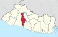
Santiago Texacuangos is a municipality in the San Salvador department of El Salvador. It is near Lake Ilopango.[1]
References
- ^ González Choto, Daniel (6 May 2008). "Proyecto de Ilopango costaría $300 millones". Siglo Veintiuno. Retrieved 31 May 2024 – via ProQuest.
13°39′N 89°07′W / 13.650°N 89.117°W / 13.650; -89.117

- v
- t
- e
 San Salvador Department
Capital: San Salvador
- Aguilares
- Apopa
- Ayutuxtepeque
- Cuscatancingo
- Delgado
- El Paisnal
- Guazapa
- Ilopango
- Mejicanos
- Nejapa
- Panchimalco
- Rosario de Mora
- San Marcos
- San Martín
- San Salvador
- Santiago Texacuangos
- Santo Tomás
- Soyapango
- Tonacatepeque
- Cerro Cinotepeque
- Cerrón Grande Reservoir
- Guazapa Volcano
- Lake Ilopango
- Casa Presidencial
- Cemetery of Distinguished Citizens
- Estadio Cuscatlán
- Estadio Jorge "Mágico" González
- Estadio Las Delicias
- Estadio Nacional de El Salvador
- Estadio Universitario UES
- Gimnasio Nacional José Adolfo Pineda
- Government Center Tower
- Iglesia El Carmen
- Ilopango International Airport
- Lifestyle Center La Gran Via
- Monumento al Divino Salvador del Mundo
- Museo de la Palabra y la Imagen
- National Palace
- Plaza Gerardo Barrios
- San Salvador Cathedral
- San Salvador Historic Downtown
- Teatro Nacional de El Salvador
- World Trade Center San Salvador
 | This El Salvador location article is a stub. You can help Wikipedia by expanding it. |
- v
- t
- e


