Sala Municipality, Sweden
Municipality in Västmanland County, Sweden
Sala Municipality Sala kommun | |
|---|---|
Municipality | |
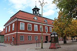 Sala Town Hall | |
 Coat of arms | |
 | |
| Coordinates: 59°55′N 16°36′E / 59.917°N 16.600°E / 59.917; 16.600 | |
| Country | Sweden |
| County | Västmanland County |
| Seat | Sala |
| Area | |
| • Total | 1,204.39 km2 (465.02 sq mi) |
| • Land | 1,166.85 km2 (450.52 sq mi) |
| • Water | 37.54 km2 (14.49 sq mi) |
| Area as of 1 January 2014. | |
| Population (31 December 2023)[2] | |
| • Total | 22,853 |
| • Density | 19/km2 (49/sq mi) |
| Time zone | UTC+1 (CET) |
| • Summer (DST) | UTC+2 (CEST) |
| ISO 3166 code | SE |
| Province | Västmanland and Uppland |
| Municipal code | 1981 |
| Website | www.sala.se |
Sala Municipality (Swedish: Sala kommun) is a municipality in Västmanland County in central Sweden. Its seat is located in the city of Sala.
The present municipality was created in 1971, when the City of Sala was amalgamated with the rural municipalities Möklinta and Tärna and a part of Västerfärnebo.
Localities
- Kila
- Kumla kyrkby
- Möklinta
- Norrbäck
- Ransta
- Sala (seat)
- Salbohed
- Sätra brunn
- Västerfärnebo
Demographics
This is a demographic table based on Sala Municipality's electoral districts in the 2022 Swedish general election sourced from SVT's election platform, in turn taken from SCB official statistics.[3]
In total there were 22,969 residents, including 17,496 Swedish citizens of voting age.[3] 46.1% voted for the left coalition and 52.6% for the right coalition. Indicators are in percentage points except population totals and income.
| Location | Residents | Citizen adults | Left vote | Right vote | Employed | Swedish parents | Foreign heritage | Income SEK | Degree |
|---|---|---|---|---|---|---|---|---|---|
| % | % | ||||||||
| Centrum | 2,070 | 1,786 | 50.1 | 49.1 | 76 | 83 | 17 | 21,676 | 29 |
| Dalhem-Gärdesta | 2,238 | 1,622 | 47.6 | 51.0 | 80 | 80 | 20 | 24,645 | 36 |
| Jakobsberg-Bryggeriet | 1,708 | 1,247 | 55.4 | 43.2 | 70 | 63 | 37 | 19,702 | 30 |
| Kila-Fläckebo | 1,722 | 1,390 | 44.2 | 53.9 | 87 | 92 | 8 | 26,910 | 36 |
| Kumla-Ransta-Tärna | 1,876 | 1,431 | 40.3 | 58.6 | 85 | 91 | 9 | 26,523 | 35 |
| Kungsängen-Valla | 1,701 | 1,383 | 50.8 | 48.0 | 87 | 81 | 19 | 26,980 | 38 |
| Möklinta | 1,237 | 949 | 33.6 | 64.2 | 80 | 90 | 10 | 22,502 | 24 |
| Sala N | 1,938 | 1,491 | 46.5 | 52.0 | 83 | 85 | 15 | 25,729 | 31 |
| Sala S | 2,307 | 1,712 | 46.5 | 52.7 | 85 | 85 | 15 | 28,039 | 38 |
| Sala Ö | 1,656 | 1,293 | 36.5 | 62.4 | 88 | 93 | 7 | 27,426 | 31 |
| Västerfärnebo | 2,106 | 1,677 | 39.6 | 59.6 | 85 | 92 | 8 | 24,113 | 29 |
| Åkra | 2,410 | 1,515 | 61.2 | 36.3 | 64 | 46 | 54 | 18,136 | 24 |
| Source: SVT[3] | |||||||||
See also
References
- ^ "Statistiska centralbyrån, Kommunarealer den 1 januari 2014" (in Swedish). Statistics Sweden. 2014-01-01. Archived from the original (Microsoft Excel) on 2016-09-27. Retrieved 2014-04-18.
- ^ "Folkmängd och befolkningsförändringar - Kvartal 4, 2023" (in Swedish). Statistics Sweden. February 22, 2024. Retrieved February 22, 2024.
- ^ a b c "Valresultat 2022 för Sala i riksdagsvalet" (in Swedish). SVT. 11 September 2022. Retrieved 30 December 2023.
External links
 Media related to Sala Municipality, Sweden at Wikimedia Commons
- Sala Municipality website
Places adjacent to Sala Municipality, Sweden | |
|---|---|


Authority control databases | |
|---|---|
| International |
|
| National |
|
| Geographic |
|


