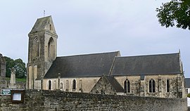
Sainte-Honorine-des-Pertes
You can help expand this article with text translated from the corresponding article in French. (December 2008) Click [show] for important translation instructions.
- View a machine-translated version of the French article.
- Machine translation, like DeepL or Google Translate, is a useful starting point for translations, but translators must revise errors as necessary and confirm that the translation is accurate, rather than simply copy-pasting machine-translated text into the English Wikipedia.
- Do not translate text that appears unreliable or low-quality. If possible, verify the text with references provided in the foreign-language article.
- You must provide copyright attribution in the edit summary accompanying your translation by providing an interlanguage link to the source of your translation. A model attribution edit summary is
Content in this edit is translated from the existing French Wikipedia article at [[:fr:Sainte-Honorine-des-Pertes]]; see its history for attribution. - You may also add the template
{{Translated|fr|Sainte-Honorine-des-Pertes}}to the talk page. - For more guidance, see Wikipedia:Translation.
Part of Aure sur Mer in Normandy, France
Sainte-Honorine-des-Pertes | |
|---|---|
Part of Aure sur Mer | |
 | |
Location of Sainte-Honorine-des-Pertes  | |
49°20′53″N 0°48′22″W / 49.3481°N 0.8061°W / 49.3481; -0.8061 | |
| Country | France |
| Region | Normandy |
| Department | Calvados |
| Arrondissement | Bayeux |
| Canton | Trévières |
| Commune | Aure sur Mer |
| Area 1 | 5.69 km2 (2.20 sq mi) |
| Population (2019)[1] | 533 |
| • Density | 94/km2 (240/sq mi) |
| Time zone | UTC+01:00 (CET) |
| • Summer (DST) | UTC+02:00 (CEST) |
| Postal code | 14520 |
| Elevation | 0–78 m (0–256 ft) (avg. 70 m or 230 ft) |
| 1 French Land Register data, which excludes lakes, ponds, glaciers > 1 km2 (0.386 sq mi or 247 acres) and river estuaries. | |
Sainte-Honorine-des-Pertes (French pronunciation: [sɛ̃t ɔnɔʁin de pɛʁt]) is a former commune in the Calvados department in the Normandy region in northwestern France. On 1 January 2017, it was merged into the new commune Aure sur Mer.[2]
History
World War II
On 13 September 1942 13 British commandos landed at night near Sainte-Honorine-des-Pertes from a Motor Torpedo Boat in Operation Aquatint, a reconnaissance mission to collect information about the surrounding area, and took a German guard prisoner.[3]
Sainte-Honorine-des-Pertes is located at the eastern end of Omaha Beach, one of the landings sites on D-Day, 6 June 1944, at the beginning of the Battle of Normandy, during World War II.
Population
| Year | Pop. | ±% |
|---|---|---|
| 1962 | 333 | — |
| 1968 | 293 | −12.0% |
| 1975 | 310 | +5.8% |
| 1982 | 371 | +19.7% |
| 1990 | 391 | +5.4% |
| 1999 | 415 | +6.1% |
| 2008 | 582 | +40.2% |
See also
- Communes of the Calvados department
- History of the local ruined Saint Simeon chapel, with images
References
Wikimedia Commons has media related to Sainte-Honorine-des-Pertes.
| Authority control databases: National |
|
|---|
- v
- t
- e


