Romsdalsalpane

Romsdalsalpane
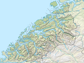
Location of the mountain
Show map of Møre og Romsdal
Romsdalsalpane
Romsdalsalpane (Norway)
Show map of NorwayRomsdalsalpane (Norwegian) or the Romsdal Alps (English) is mountain range surrounding the Romsdalen valley in Møre og Romsdal county, Norway. They are primarily located in Rauma Municipality, Molde Municipality, and Fjord Municipality. The southern part of the mountain range is also located within Reinheimen National Park. The famous Trollstigen road runs over a pass in this mountain range.[1]
Mountains in the range include:
- Store Venjetind at 1,852 metres (6,076 ft)
- Store Trolltind at 1,788 metres (5,866 ft), the highest point along the Troll Wall ridge
- Trollryggen at 1,740 metres (5,710 ft)
- Romsdalshorn at 1,550 metres (5,090 ft)
- Kyrkjetaket at 1,439 metres (4,721 ft)
See also
References
- ^ "Welcome to the Romsdal alps". Retrieved 2010-10-26.
- v
- t
- e


