Romilly, Vale of Glamorgan
51°23′53″N 3°17′13″W / 51.398°N 3.287°W / 51.398; -3.287
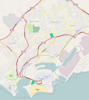
District of Barry in Wales

Romilly
Location in Barry
Romilly is a western district of Barry in the Vale of Glamorgan, South Wales, United Kingdom.
The area has an attractive public park which includes an extensive field and tennis court facilities. It is located around the corner from Cold Knap. An educational centre was built on Romilly Road in 1957.[1] The park is listed at Grade II on the Cadw/ICOMOS Register of Parks and Gardens of Special Historic Interest in Wales.[2]

References
- ^ Williams, Glanmor (1984). Early Glamorgan: pre-history and early history. Printed and published for the Committee by W. Lewis (printers) limited. p. 259. ISBN 978-0-904730-04-3. Retrieved 6 December 2012.
- ^ Cadw. "Romilly Park (PGW(Gm)63(GLA))". National Historic Assets of Wales. Retrieved 6 February 2023.
- v
- t
- e
- Barry Island
- Buttrills
- Cadoxton
- Colcot
- Cold Knap
- Cwm Talwg
- Gibbonsdown
- Gladstone
- Great Brynhill
- Holton
- Jenner Park
- Merthyr Dyfan
- Nant Talwg
- Palmerston
- Pencoedtre
- Porthkerry (nearby)
- Romilly
- Barry Castle
- Barry Community Hospital
- Barry Memorial Hall
- Barry Council Office and Library
- Barry Dock Offices
- Butlin's Barry Island (demolished)
- Egerton Grey Country House Hotel
- Jackson's Bay
- Porthkerry Park
- Porthkerry Viaduct
- Welsh Hawking Centre
- Barry Town Council
- See also Category:People from Barry, Vale of Glamorgan
See also: Template:Vale of Glamorgan for wider county topics
 | This Vale of Glamorgan location article is a stub. You can help Wikipedia by expanding it. |
- v
- t
- e


