Robertson Boulevard
Street in Los Angeles
 I-10 / Santa Monica Freeway
 SR 2 / Santa Monica Boulevard


Robertson Boulevard is a street in Los Angeles, in the U.S. state of California, that also passes through the incorporated cities of West Hollywood, Beverly Hills, and Culver City.
Location
Robertson Boulevard is a major north–south thoroughfare on the Westside of Los Angeles running through one of its neighborhoods, Pico-Robertson and between two of its neighborhoods, Beverlywood and Crestview. Its northern end is slightly to the north of Santa Monica Boulevard at Keith Avenue in West Hollywood and its southern end is at Washington Boulevard in Culver City. Robertson Boulevard is accessible via exit #6 on the Santa Monica Freeway (Interstate 10).
Overview
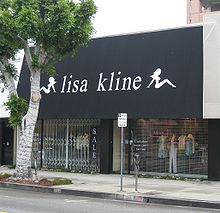
The northern part of the street in West Hollywood and Beverly Hills is a trendy tree-lined shopping district. In West Hollywood, the neighborhood surrounding Robertson Boulevard consists mostly of high-density apartment buildings and condominiums. The residential area surrounding the Robertson Boulevard shopping district in Beverly Hills is more family-oriented and is made up mostly of single-family residences.
Robertson Boulevard has recently become a haven for celebrities and paparazzi. This is partially due to a large influx of unique boutiques and designer clothing & jewelry stores which are a mecca for many celebrity shoppers. In addition, several popular celebrity-infused eateries are located on Robertson Boulevard. The Kabbalah Centre is also located on the street.
South of West Hollywood and Beverly Hills and north of Culver City, Pico-Robertson, Beverlywood and Crestview are upper-middle-class neighborhoods in West Los Angeles with a historical and substantial Jewish population. Alexander Hamilton High School, a highly diverse high school in the Beverlywood neighborhood in West Los Angeles is on Robertson Boulevard.
The southern terminus of Robertson Boulevard is Washington Boulevard in Culver City, where it then continues as Higuera Street (which itself later becomes Obama Boulevard).
The Robertson Branch of Los Angeles Public Library is located at 1719 S. Robertson near the intersection of Airdrome.
Public transportation
Metro Local line 617 runs along Robertson Boulevard. The Metro E Line operates a rail station at Venice Boulevard.
References
- v
- t
- e
- Alameda St.
- Alvarado St.
- Atlantic Blvd./Atlantic Ave.
- Avalon Blvd.
- Aviation Blvd.
- Azusa Ave.
- Beverly Dr.
- Beverly Glen Blvd.
- Broadway
- Cahuenga Blvd.
- Central Ave.
- Crenshaw Blvd.
- Doheny Dr.
- Fairfax Ave.
- Fair Oaks Ave.
- Figueroa St.
- Garfield Ave./Cherry Ave.
- Glendale Blvd./Brand Blvd.
- Gower St.
- Grand Ave.
- Highland Ave.
- Hill St.
- Hoover
- La Brea Ave./Hawthorne Blvd.
- La Cienega Blvd.
- Lake Ave.
- Laurel Canyon Blvd./Crescent Heights Blvd.
- Lincoln Blvd.
- Los Angeles St.
- Main St.
- Normandie Ave.
- Ocean Ave.
- Orange Grove Blvd.
- Robertson Blvd.
- Rosemead Blvd./Lakewood Blvd.
- San Fernando Rd.
- San Pedro St.
- Sawtelle Blvd.
- Sepulveda Blvd.
- Sierra Hwy.
- Sierra Madre Blvd.
- Soto St.
- Pacific Blvd./Long Beach Blvd.
- Pacific Coast Hwy.
- Vermont Ave.
- Vine St.
- Western Ave.
- Westwood Blvd.
- Wilcox Ave.
- Adams Blvd.
- Alondra Blvd.
- Angeles Crest Hwy.
- Arrow Hwy.
- Artesia Blvd.
- Bandini Blvd.
- Beverly Blvd.
- Carroll Ave.
- Carson St.
- Century Blvd.
- Colima Rd./Golden Springs Dr.
- Compton Blvd./Marine Ave.
- Culver Blvd.
- Del Amo Blvd.
- El Segundo Blvd.
- Florence Ave.
- Franklin Ave.
- Garvey Ave.
- Hollywood Blvd.
- Huntington Dr.
- Imperial Hwy.
- Jefferson Blvd.
- Lomita Blvd.
- Los Feliz Blvd.
- Manchester Ave./Firestone Blvd.
- Manhattan Beach Blvd.
- Martin Luther King Jr. Blvd.
- Melrose Ave.
- Montana Ave.
- Mulholland Dr.
- Nadeau
- Obama Blvd.
- Olympic Blvd.
- Pico Blvd.
- Rosecrans Ave.
- Santa Monica Blvd.
- Slauson Ave.
- Sunset Blvd./Cesar Chavez Ave.
- Temple St.
- Vernon Ave.
- Venice Blvd.
- Washington Blvd.
- Whittier Blvd.
- Wilshire Blvd.
- Arrow Hwy.
- Balboa Blvd.
- Cahuenga Blvd.
- Coldwater Canyon Ave.
- Colorado Blvd.
- Foothill Blvd.
- Glenoaks Blvd.
- Lankershim Blvd.
- Laurel Canyon Blvd.
- Mulholland Dr.
- Reseda Blvd.
- Riverside Dr.
- San Fernando Rd.
- Sepulveda Blvd.
- Sierra Hwy.
- Sunland Blvd./Vineland Ave.
- Topanga Canyon Blvd.
- Valley Blvd.
- Van Nuys Blvd.
- Ventura Blvd.
- Victory Blvd.
traffic circles
- Gower Gulch
- Hollywood and Vine
- Naud Junction
- SM Entertainment Square
- Sunset Junction
- Abbot Kinney Blvd.
- California Incline
- Centinela Ave./Bundy Dr.
- Pacific Coast Hwy.
- San Vicente Blvd.
- Telegraph Rd.
- Gaffey St.
- Western Ave.
- 77 Sunset Strip
- "All I Wanna Do"
- "Blue Jay Way"
- "Dead Man's Curve"
- "Down Rodeo"
- "Free Fallin'"
- "I Love L.A."
- King of the Mountain
- "LA Devotee"
- Mulholland Drive
- "Pico and Sepulveda"
- Sunset Boulevard (film, musical)
- Vine Street (+Live+ song)
All un-suffixed roads are streets unless otherwise noted.
34°01′33″N 118°23′25″W / 34.0259°N 118.3902°W / 34.0259; -118.3902
 | This California road–related article is a stub. You can help Wikipedia by expanding it. |
- v
- t
- e


