Răcari
Town in Dâmbovița, Romania

Coat of arms
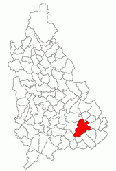
Location in Dâmbovița County
(2021-12-01)[2]
137385
Răcari is a town located in Dâmbovița County, Muntenia, Romania. It administers seven villages: Bălănești, Colacu, Ghergani, Ghimpați, Mavrodin, Săbiești, and Stănești. It was declared a town in 2004.
The town is located in the southeastern part of the county, 40 km (25 mi) northwest of Bucharest, on road DN7. It lies in the Wallachian Plain, at an altitude of 140 m (460 ft), and is traversed by the rivers Colentina and Ilfov. Răcari borders the following communes: Bilciurești and Cojasca to the north, Tărtășești and Ciocănești to the south, Butimanu to the east, and Conțești and Cornățelu to the west.
| Year | Pop. | ±% |
|---|---|---|
| 1948 | 2,519 | — |
| 2002 | 6,892 | +173.6% |
| 2011 | 6,638 | −3.7% |
| 2021 | 6,306 | −5.0% |
| Source: Census data | ||
Notable residents
- Ion Ghica, Prince of Samos (1854–1859) and the 5th Prime Minister of Romania (1866), died in 1897 at his estate in Ghergani.
- Donar Munteanu (1886–1972), a poet, was born in Răcari.
References
Wikimedia Commons has media related to Răcari.
- v
- t
- e
- Târgoviște (county seat)
- Moreni

- Aninoasa
- Băleni
- Bărbulețu
- Bezdead
- Bilciurești
- Brănești
- Braniștea
- Brezoaele
- Buciumeni
- Bucșani
- Butimanu
- Cândești
- Ciocănești
- Cobia
- Cojasca
- Comișani
- Conțești
- Corbii Mari
- Cornățelu
- Cornești
- Costeștii din Vale
- Crângurile
- Crevedia
- Dărmănești
- Dobra
- Doicești
- Dragodana
- Dragomirești
- Finta
- Glodeni
- Gura Foii
- Gura Ocniței
- Gura Șuții
- Hulubești
- I. L. Caragiale
- Iedera
- Lucieni
- Ludești
- Lungulețu
- Malu cu Flori
- Mănești
- Mătăsaru
- Mogoșani
- Moroeni
- Morteni
- Moțăieni
- Niculești
- Nucet
- Ocnița
- Odobești
- Perșinari
- Petrești
- Pietrari
- Pietroșița
- Poiana
- Potlogi
- Produlești
- Pucheni
- Raciu
- Răscăeți
- Râu Alb
- Răzvad
- Runcu
- Sălcioara
- Șelaru
- Slobozia Moară
- Șotânga
- Tărtășești
- Tătărani
- Uliești
- Ulmi
- Văcărești
- Valea Lungă
- Valea Mare
- Văleni-Dâmbovița
- Vârfuri
- Vișina
- Vișinești
- Vlădeni
- Voinești
- Vulcana-Băi
- Vulcana-Pandele
| Authority control databases |
|
|---|
 | This Dâmbovița County location article is a stub. You can help Wikipedia by expanding it. |
- v
- t
- e


