Ponta Temerosa
14°54′01″N 23°30′32″W / 14.9003°N 23.5090°W / 14.9003; -23.5090Location Praia, Santiago, Cape Verde Offshore water bodies Praia Harbor
Atlantic Ocean 
1884 Map of Praia with Ponta Temerosa Mountains 
Streams Points and promontories Other geographic features Transportation Other topics
Atlantic Ocean
Ponta Temerosa is a headland on the island of Santiago, Cape Verde. Located in the south of the capital Praia, it is the southernmost point of the island. It is 2 km south from the city center. The lighthouse Farol de D. Maria Pia stands at the eastern point of the headland, marking the entrance to the Praia Harbour.[1]

References
- ^ Rowlett, Russ. "Lighthouses of Cape Verde". The Lighthouse Directory. University of North Carolina at Chapel Hill.
- v
- t
- e
The island of Santiago
- Pico de Antónia
- Monte Graciosa
- Serra Malagueta
- Monte Tchota
- Monte das Vacas

- Ribeira Grande de Santiago
- Ribeira Principal
- Ribeira Seca
- Ribeira da Trindade
- Ponta Bicuda
- Ponta das Bicudas
- Ponta do Lobo
- Ponta Moreia
- Ponta Preta
- Ponta Temerosa
 Category

| ||
|---|---|---|
| Neighbourhoods |  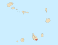 | |
| Geographical features | ||
| Education | ||
| Landmarks | ||
| Culture |
| |
| Sports | ||
| Transportation | ||
| Media | ||
| History |
| |
| ||


