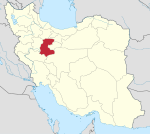
Pol-e Doab Rural District
Rural district in Markazi province, Iran
Rural District in Markazi, Iran
Pol-e Doab Rural District Persian: دهستان پل دوآب | |
|---|---|
| 34°05′29″N 49°17′31″E / 34.09139°N 49.29194°E / 34.09139; 49.29194[1] | |
| Country | Iran |
| Province | Markazi |
| County | Shazand |
| District | Zalian |
| Capital | Tureh |
| Population (2016)[2] | |
| • Total | 10,752 |
| Time zone | UTC+3:30 (IRST) |
Pol-e Doab Rural District (Persian: دهستان پل دوآب) is in Zalian District of Shazand County, Markazi province, Iran.[3] It is administered from the city of Tureh.[4]
Demographics
Population
At the time of the 2006 National Census, the rural district's population was 27,846 in 7,365 households.[5] There were 12,836 inhabitants in 3,818 households at the following census of 2011.[6] The 2016 census measured the population of the rural district as 10,752 in 3,539 households. The most populous of its 42 villages was Hesar, with 2,201 people.[2]
See also
 Iran portal
References
- ^ OpenStreetMap contributors (2 September 2023). "Pol-e Doab Rural District (Shazand County)" (Map). OpenStreetMap (in Persian). Retrieved 2 September 2023.
- ^ a b "Census of the Islamic Republic of Iran, 1395 (2016)". AMAR (in Persian). The Statistical Center of Iran. p. 00. Archived from the original (Excel) on 17 October 2020. Retrieved 19 December 2022.
- ^ Habibi, Hassan. "Reforms of country divisions within Markazi province". Islamic Parliament Research Center (in Persian). Ministry of Interior, Political-Defense Commission of the Government Board. Archived from the original on 6 August 2012. Retrieved 18 January 2024.
- ^ "Creation and formation of six rural districts including villages, farms and places in a certain geographical area in Shazand County under Markazi province". Islamic Parliament Research Center (in Persian). Ministry of Interior, Board of Ministers. Archived from the original on 23 August 2014. Retrieved 18 January 2024.
- ^ "Census of the Islamic Republic of Iran, 1385 (2006)". AMAR (in Persian). The Statistical Center of Iran. p. 00. Archived from the original (Excel) on 20 September 2011. Retrieved 25 September 2022.
- ^ "Census of the Islamic Republic of Iran, 1390 (2011)". Syracuse University (in Persian). The Statistical Center of Iran. p. 00. Archived from the original (Excel) on 19 January 2023. Retrieved 19 December 2022.
- v
- t
- e
Markazi Province, Iran

| Arak County | |
|---|---|
| Ashtian County | |
| Delijan County | |
| Farahan County | |
| Khomeyn County | |
| Khondab County | |
| Komijan County | |
| Mahallat County | |
| Saveh County | |
| Shazand County | |
| Tafresh County | |
| Zarandieh County |
- Chal nakhjir cave, Delijan
- Khorheh
- Atashkoh fire temple, Nimvar
- Mausoleum of Mahmoud Hessaby ,Tafresh
- Arak's grand Bazzar
- Mahallat's flower and plant festival
- Aveh ancient cite, Saveh
- Chaharfasl bath museum, Arak
- Hezaveh village
- Jameh Mosque of Saveh
- Panzdah khordad dam
- Emarat lake, Shazand
- Azadkhan cave, Mahallat
- Miqan Wetland
- Mostufi-al-mamalek's castle, Ashtian
- Dudahak caravansary, Delijan
- Naragh's historical complex
- Sepahdar school, Arak
- Sheshnaveh mosque
- Mahdiabad's Yakhchal
 | This Shazand County location article is a stub. You can help Wikipedia by expanding it. |
- v
- t
- e


