Petacas
![Petacas is located in Colombia](http://upload.wikimedia.org/wikipedia/commons/thumb/2/2b/Colombia_relief_location_map.jpg/272px-Colombia_relief_location_map.jpg)
![Petacas](http://upload.wikimedia.org/wikipedia/en/thumb/3/39/Red_triangle_with_thick_white_border.svg/16px-Red_triangle_with_thick_white_border.svg.png)
Petacas
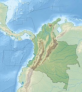
Location of Petacas in Colombia
![](http://upload.wikimedia.org/wikipedia/commons/thumb/2/21/Flag_of_Colombia.svg/23px-Flag_of_Colombia.svg.png)
Andean Volcanic Belt
Petacas is a lava dome in the departments of Cauca and Nariño, Colombia.[1]
Doña Juana volcano lies nearby.[1] Both volcanoes are located between the El Tablón Fault to the west and the San Jerónimo Fault to the east.[2]
See also
References
- ^ a b "Petacas". Global Volcanism Program. Smithsonian Institution.
- ^ Plancha 411, 2002
Bibliography
- Núñez, Alberto, and Jorge Gómez. 2002. Plancha 411 - La Cruz - 1:100,000, 1. INGEOMINAS. Accessed 2017-06-06.
- v
- t
- e
![Petacas is located in Colombia](http://upload.wikimedia.org/wikipedia/commons/thumb/2/2b/Colombia_relief_location_map.jpg/170px-Colombia_relief_location_map.jpg)
![Azufral](http://upload.wikimedia.org/wikipedia/commons/thumb/3/32/Wallpaper_group_diagram_legend_rotation3.svg/10px-Wallpaper_group_diagram_legend_rotation3.svg.png)
![Alto Mellizos](http://upload.wikimedia.org/wikipedia/commons/thumb/3/32/Wallpaper_group_diagram_legend_rotation3.svg/10px-Wallpaper_group_diagram_legend_rotation3.svg.png)
![Las Ánimas](http://upload.wikimedia.org/wikipedia/commons/thumb/3/32/Wallpaper_group_diagram_legend_rotation3.svg/10px-Wallpaper_group_diagram_legend_rotation3.svg.png)
![Bordoncillo](http://upload.wikimedia.org/wikipedia/commons/thumb/3/32/Wallpaper_group_diagram_legend_rotation3.svg/10px-Wallpaper_group_diagram_legend_rotation3.svg.png)
![Cerro Bravo](http://upload.wikimedia.org/wikipedia/commons/thumb/3/32/Wallpaper_group_diagram_legend_rotation3.svg/10px-Wallpaper_group_diagram_legend_rotation3.svg.png)
![Cerro Machín](http://upload.wikimedia.org/wikipedia/commons/thumb/3/32/Wallpaper_group_diagram_legend_rotation3.svg/10px-Wallpaper_group_diagram_legend_rotation3.svg.png)
![Cerro Negro de Mayasquer](http://upload.wikimedia.org/wikipedia/commons/thumb/3/32/Wallpaper_group_diagram_legend_rotation3.svg/10px-Wallpaper_group_diagram_legend_rotation3.svg.png)
![Chiles](http://upload.wikimedia.org/wikipedia/commons/thumb/3/32/Wallpaper_group_diagram_legend_rotation3.svg/10px-Wallpaper_group_diagram_legend_rotation3.svg.png)
![Cumbal Volcano](http://upload.wikimedia.org/wikipedia/commons/thumb/3/32/Wallpaper_group_diagram_legend_rotation3.svg/10px-Wallpaper_group_diagram_legend_rotation3.svg.png)
![Doña Juana](http://upload.wikimedia.org/wikipedia/commons/thumb/3/32/Wallpaper_group_diagram_legend_rotation3.svg/10px-Wallpaper_group_diagram_legend_rotation3.svg.png)
![El Escondido](http://upload.wikimedia.org/wikipedia/commons/thumb/3/32/Wallpaper_group_diagram_legend_rotation3.svg/10px-Wallpaper_group_diagram_legend_rotation3.svg.png)
![Galeras](http://upload.wikimedia.org/wikipedia/commons/thumb/3/32/Wallpaper_group_diagram_legend_rotation3.svg/10px-Wallpaper_group_diagram_legend_rotation3.svg.png)
![Morasurco](http://upload.wikimedia.org/wikipedia/commons/thumb/3/32/Wallpaper_group_diagram_legend_rotation3.svg/10px-Wallpaper_group_diagram_legend_rotation3.svg.png)
![Nevado El Cisne](http://upload.wikimedia.org/wikipedia/commons/thumb/3/32/Wallpaper_group_diagram_legend_rotation3.svg/10px-Wallpaper_group_diagram_legend_rotation3.svg.png)
![Nevado del Huila](http://upload.wikimedia.org/wikipedia/commons/thumb/3/32/Wallpaper_group_diagram_legend_rotation3.svg/10px-Wallpaper_group_diagram_legend_rotation3.svg.png)
![Nevado del Quindío](http://upload.wikimedia.org/wikipedia/commons/thumb/3/32/Wallpaper_group_diagram_legend_rotation3.svg/10px-Wallpaper_group_diagram_legend_rotation3.svg.png)
![Nevado del Ruiz](http://upload.wikimedia.org/wikipedia/commons/thumb/3/32/Wallpaper_group_diagram_legend_rotation3.svg/10px-Wallpaper_group_diagram_legend_rotation3.svg.png)
![Santa Isabel](http://upload.wikimedia.org/wikipedia/commons/thumb/3/32/Wallpaper_group_diagram_legend_rotation3.svg/10px-Wallpaper_group_diagram_legend_rotation3.svg.png)
![Nevado del Tolima](http://upload.wikimedia.org/wikipedia/commons/thumb/3/32/Wallpaper_group_diagram_legend_rotation3.svg/10px-Wallpaper_group_diagram_legend_rotation3.svg.png)
![Patascoy](http://upload.wikimedia.org/wikipedia/commons/thumb/3/32/Wallpaper_group_diagram_legend_rotation3.svg/10px-Wallpaper_group_diagram_legend_rotation3.svg.png)
![Petacas](http://upload.wikimedia.org/wikipedia/commons/thumb/3/32/Wallpaper_group_diagram_legend_rotation3.svg/10px-Wallpaper_group_diagram_legend_rotation3.svg.png)
![Puracé](http://upload.wikimedia.org/wikipedia/commons/thumb/3/32/Wallpaper_group_diagram_legend_rotation3.svg/10px-Wallpaper_group_diagram_legend_rotation3.svg.png)
![Romeral](http://upload.wikimedia.org/wikipedia/commons/thumb/3/32/Wallpaper_group_diagram_legend_rotation3.svg/10px-Wallpaper_group_diagram_legend_rotation3.svg.png)
![San Diego](http://upload.wikimedia.org/wikipedia/commons/thumb/3/32/Wallpaper_group_diagram_legend_rotation3.svg/10px-Wallpaper_group_diagram_legend_rotation3.svg.png)
![Sotará](http://upload.wikimedia.org/wikipedia/commons/thumb/3/32/Wallpaper_group_diagram_legend_rotation3.svg/10px-Wallpaper_group_diagram_legend_rotation3.svg.png)
![Paipa-Iza volcanic complex](http://upload.wikimedia.org/wikipedia/commons/thumb/3/32/Wallpaper_group_diagram_legend_rotation3.svg/10px-Wallpaper_group_diagram_legend_rotation3.svg.png)
![Isla de Providencia](http://upload.wikimedia.org/wikipedia/commons/thumb/5/54/Blue_Fire.svg/9px-Blue_Fire.svg.png)
![El Totumo](http://upload.wikimedia.org/wikipedia/commons/thumb/5/50/ArrowUp.svg/9px-ArrowUp.svg.png)
- Alto Mellizos
- Las Ánimas
- Bordoncillo
- Cerro Bravo
- Cerro Machín
- Doña Juana
- El Escondido
- Galeras
- Morasurco
- Nevado El Cisne
- Nevado del Huila
- Nevado del Quindío
- Nevado del Ruiz
- Nevado de Santa Isabel
- Nevado del Tolima
- Patascoy
- Petacas
- Puracé
- Romeral
- San Diego
- Sotará
- • "Observatorios Vulcanológicos". Servicio Geológico de Colombia.
![](http://upload.wikimedia.org/wikipedia/en/thumb/9/96/Symbol_category_class.svg/16px-Symbol_category_class.svg.png)
![](http://upload.wikimedia.org/wikipedia/en/thumb/9/9c/Symbol_file_class.svg/16px-Symbol_file_class.svg.png)
![]() | This Colombian location article is a stub. You can help Wikipedia by expanding it. |
- v
- t
- e
![]() | This volcanology article is a stub. You can help Wikipedia by expanding it. |
- v
- t
- e