Municipality of Gornji Grad
Municipality of Slovenia
Municipality in Slovenia
Municipality of Gornji Grad Občina Gornji Grad | |
|---|---|
Municipality | |
 | |
 Coat of arms | |
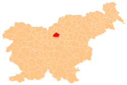 Location of the Municipality of Gornji Grad in Slovenia | |
| Coordinates: 46°18′N 14°48′E / 46.300°N 14.800°E / 46.300; 14.800 | |
| Country |  Slovenia Slovenia |
| Government | |
| • Mayor | Anton Špeh |
| Area | |
| • Total | 90.1 km2 (34.8 sq mi) |
| Population (2002)[1] | |
| • Total | 2,595 |
| • Density | 29/km2 (75/sq mi) |
| Time zone | UTC+01 (CET) |
| • Summer (DST) | UTC+02 (CEST) |
| Website | www |
The Municipality of Gornji Grad (pronounced [ˈɡoːɾnji ˈɡɾaːt] ⓘ; Slovene: Občina Gornji Grad) is a municipality in Slovenia. The seat of the municipality is the town of Gornji Grad. It lies on the Dreta River in the foothills of the Savinja Alps. Traditionally it belonged to the region of Styria and it is now included in the Savinja Statistical Region.[2]
Settlements
In addition to the municipal seat of Gornji Grad, the municipality also includes the following settlements:
References
External links
 Media related to Municipality of Gornji Grad at Wikimedia Commons
- Municipality of Gornji Grad on Geopedia
- Gornji Grad municipal site (in Slovene)
Places adjacent to Municipality of Gornji Grad | ||||||||||||||||
|---|---|---|---|---|---|---|---|---|---|---|---|---|---|---|---|---|
| ||||||||||||||||


- v
- t
- e
Municipality of Gornji Grad
Administrative seat: Gornji Grad
| Current | |
|---|---|
| Former |
|

- Assumption of Mary Church
- Presentation of Mary Church
- Gornji Grad Parish Church
- Nova Štifta Parish Church
- St. Nicholas' Church
Authority control databases | |
|---|---|
| International |
|
| National |
|
 | This article about the Municipality of Gornji Grad in Slovenia is a stub. You can help Wikipedia by expanding it. |
- v
- t
- e


