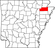
List of lakes of Craighead County, Arkansas
Map all coordinates using OpenStreetMap
Download coordinates as:
- KML
- GPX (all coordinates)
- GPX (primary coordinates)
- GPX (secondary coordinates)
There are at least 27 named lakes and reservoirs in Craighead County, Arkansas.
Lakes
According to the United States Geological Survey, there are no named lakes in Craighead County.
Reservoirs
- Big Creek Site Four Reservoir, 35°57′48″N 090°42′24″W / 35.96333°N 90.70667°W / 35.96333; -90.70667 (Big Creek Site Four Reservoir), el. 407 feet (124 m) [1]
- Big Creek Site Five Reservoir, 35°58′24″N 090°44′00″W / 35.97333°N 90.73333°W / 35.97333; -90.73333 (Big Creek Site Five Reservoir), el. 413 feet (126 m) [2]
- Big Creek Site Six Reservoir, 35°55′54″N 090°43′52″W / 35.93167°N 90.73111°W / 35.93167; -90.73111 (Big Creek Site Six Reservoir), el. 367 feet (112 m) [3]
- Big Creek Site Seven Reservoir, 35°55′02″N 090°44′01″W / 35.91722°N 90.73361°W / 35.91722; -90.73361 (Big Creek Site Seven Reservoir), el. 331 feet (101 m) [4]
- Big Creek Site Eight Reservoir, 35°54′14″N 090°44′40″W / 35.90389°N 90.74444°W / 35.90389; -90.74444 (Big Creek Site Eight Reservoir), el. 338 feet (103 m) [5]
- Big Creek Site Nine Reservoir, 35°53′12″N 090°44′30″W / 35.88667°N 90.74167°W / 35.88667; -90.74167 (Big Creek Site Nine Reservoir), el. 315 feet (96 m) [6]
- Big Creek Site 10 Reservoir, 35°53′20″N 090°46′33″W / 35.88889°N 90.77583°W / 35.88889; -90.77583 (Big Creek Site 10 Reservoir), el. 328 feet (100 m) [7]
- Big Creek Site 11 Reservoir, 35°52′12″N 090°47′18″W / 35.87000°N 90.78833°W / 35.87000; -90.78833 (Big Creek Site 11 Reservoir), el. 308 feet (94 m) [8]
- Big Creek Site 13 Reservoir, 35°49′03″N 090°46′15″W / 35.81750°N 90.77083°W / 35.81750; -90.77083 (Big Creek Site 13 Reservoir), el. 308 feet (94 m) [9]
- Big Creek Site 14 Reservoir, 35°49′24″N 090°45′12″W / 35.82333°N 90.75333°W / 35.82333; -90.75333 (Big Creek Site 14 Reservoir), el. 361 feet (110 m) [10]
- Big Creek Site 15 Reservoir, 35°58′07″N 090°40′12″W / 35.96861°N 90.67000°W / 35.96861; -90.67000 (Big Creek Site 15 Reservoir), el. 371 feet (113 m) [11]
- Big Creek Site 16 Reservoir, 35°58′00″N 090°39′00″W / 35.96667°N 90.65000°W / 35.96667; -90.65000 (Big Creek Site 16 Reservoir), el. 440 feet (130 m) [12]
- Big Creek Site 17 Reservoir, 35°55′54″N 090°41′00″W / 35.93167°N 90.68333°W / 35.93167; -90.68333 (Big Creek Site 17 Reservoir), el. 364 feet (111 m) [13]
- Big Creek Site 18 Reservoir, 35°55′24″N 090°39′00″W / 35.92333°N 90.65000°W / 35.92333; -90.65000 (Big Creek Site 18 Reservoir), el. 361 feet (110 m) [14]
- Big Creek Site 19 Reservoir, 35°53′00″N 090°40′36″W / 35.88333°N 90.67667°W / 35.88333; -90.67667 (Big Creek Site 19 Reservoir), el. 328 feet (100 m) [15]
- Big Creek Site 20 Reservoir, 35°53′00″N 090°41′54″W / 35.88333°N 90.69833°W / 35.88333; -90.69833 (Big Creek Site 20 Reservoir), el. 361 feet (110 m) [16]
- Big Creek Site 21 Reservoir, 35°47′48″N 090°45′30″W / 35.79667°N 90.75833°W / 35.79667; -90.75833 (Big Creek Site 21 Reservoir), el. 364 feet (111 m) [17]
- Big Creek Site 22 Reservoir, 35°47′48″N 090°45′36″W / 35.79667°N 90.76000°W / 35.79667; -90.76000 (Big Creek Site 22 Reservoir), el. 381 feet (116 m) [18]
- Big Pond, 35°50′36″N 090°39′18″W / 35.84333°N 90.65500°W / 35.84333; -90.65500 (Big Pond), el. 331 feet (101 m) [19]
- Cole Pond, 35°50′30″N 090°49′42″W / 35.84167°N 90.82833°W / 35.84167; -90.82833 (Cole Pond), el. 302 feet (92 m) [20]
- Craighead Forest Lake, 35°46′43″N 090°42′17″W / 35.77861°N 90.70472°W / 35.77861; -90.70472 (Craighead Forest Lake), el. 354 feet (108 m) [21]
- Farmers Lake, 35°44′14″N 090°47′59″W / 35.73722°N 90.79972°W / 35.73722; -90.79972 (Farmers Lake), el. 249 feet (76 m) [22]
- Guy Parden Pond, 35°54′42″N 090°45′30″W / 35.91167°N 90.75833°W / 35.91167; -90.75833 (Guy Parden Pond), el. 410 feet (120 m) [23]
- J L Craft Pond, 35°55′24″N 090°46′12″W / 35.92333°N 90.77000°W / 35.92333; -90.77000 (J L Craft Pond), el. 390 feet (120 m) [24]
- Mary Simpson Pond, 35°47′01″N 090°44′01″W / 35.78361°N 90.73361°W / 35.78361; -90.73361 (Mary Simpson Pond), el. 325 feet (99 m) [25]
- Poinsett Watershed Site 20 Reservoir, 35°47′18″N 090°41′18″W / 35.78833°N 90.68833°W / 35.78833; -90.68833 (Poinsett Watershed Site 20 Reservoir), el. 295 feet (90 m) [26]
- Ralph Cox Pond, 35°52′54″N 090°46′42″W / 35.88167°N 90.77833°W / 35.88167; -90.77833 (Ralph Cox Pond), el. 312 feet (95 m) [27]
See also
 United States portal

Notes
- ^ "Big Creek Site Four Reservoir". Geographic Names Information System. United States Geological Survey, United States Department of the Interior.
- ^ "Big Creek Site Five Reservoir". Geographic Names Information System. United States Geological Survey, United States Department of the Interior.
- ^ "Big Creek Site Six Reservoir". Geographic Names Information System. United States Geological Survey, United States Department of the Interior.
- ^ "Big Creek Site Seven Reservoir". Geographic Names Information System. United States Geological Survey, United States Department of the Interior.
- ^ "Big Creek Site Eight Reservoir". Geographic Names Information System. United States Geological Survey, United States Department of the Interior.
- ^ "Big Creek Site Nine Reservoir". Geographic Names Information System. United States Geological Survey, United States Department of the Interior.
- ^ "Big Creek Site 10 Reservoir". Geographic Names Information System. United States Geological Survey, United States Department of the Interior.
- ^ "Big Creek Site 11 Reservoir". Geographic Names Information System. United States Geological Survey, United States Department of the Interior.
- ^ "Big Creek Site 13 Reservoir". Geographic Names Information System. United States Geological Survey, United States Department of the Interior.
- ^ "Big Creek Site 14 Reservoir". Geographic Names Information System. United States Geological Survey, United States Department of the Interior.
- ^ "Big Creek Site 15 Reservoir". Geographic Names Information System. United States Geological Survey, United States Department of the Interior.
- ^ "Big Creek Site 16 Reservoir". Geographic Names Information System. United States Geological Survey, United States Department of the Interior.
- ^ "Big Creek Site 17 Reservoir". Geographic Names Information System. United States Geological Survey, United States Department of the Interior.
- ^ "Big Creek Site 18 Reservoir". Geographic Names Information System. United States Geological Survey, United States Department of the Interior.
- ^ "Big Creek Site 19 Reservoir". Geographic Names Information System. United States Geological Survey, United States Department of the Interior.
- ^ "Big Creek Site 20 Reservoir". Geographic Names Information System. United States Geological Survey, United States Department of the Interior.
- ^ "Big Creek Site 21 Reservoir". Geographic Names Information System. United States Geological Survey, United States Department of the Interior.
- ^ "Big Creek Site 22 Reservoir". Geographic Names Information System. United States Geological Survey, United States Department of the Interior.
- ^ "Big Pond". Geographic Names Information System. United States Geological Survey, United States Department of the Interior.
- ^ "Cole Pond". Geographic Names Information System. United States Geological Survey, United States Department of the Interior.
- ^ "Craighead Forest Lake". Geographic Names Information System. United States Geological Survey, United States Department of the Interior.
- ^ "Farmers Lake". Geographic Names Information System. United States Geological Survey, United States Department of the Interior.
- ^ "Guy Parden Pond". Geographic Names Information System. United States Geological Survey, United States Department of the Interior.
- ^ "J L Craft Pond". Geographic Names Information System. United States Geological Survey, United States Department of the Interior.
- ^ "Mary Simpson Pond". Geographic Names Information System. United States Geological Survey, United States Department of the Interior.
- ^ "Poinsett Watershed Site 20 Reservoir". Geographic Names Information System. United States Geological Survey, United States Department of the Interior.
- ^ "Ralph Cox Pond". Geographic Names Information System. United States Geological Survey, United States Department of the Interior.
- v
- t
- e
Municipalities and communities of Craighead County, Arkansas, United States
County seats: Jonesboro and Lake City
communities
- Arkansas portal
- United States portal


