Kolia
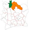
Place in Savanes, Ivory Coast
9°48′N 6°28′W / 9.800°N 6.467°W / 9.800; -6.467 Ivory Coast
 (2021 census)[2]
Kolia is a town in northern Ivory Coast. It is a sub-prefecture and commune of Kouto Department in Bagoué Region, Savanes District.
In 2021, the population of the sub-prefecture of Kolia was 32,113.[2]
Villages
The 10 villages of the sub-prefecture of Kolia and their population in 2014 are :[1]
- Kolia (12 124)
- Blediemene (1 341)
- Dabakaha (50)
- Mararanama (2 521)
- Fanhandougou (1 259)
- Katanra (1 242)
- Kodiaga (327)
- Koro (1 489)
- Kpafonon (1 702)
- Monongo (2 793)
Notes
- ^ a b Citypopulation.de Population of the localities in the sub-prefecture of Kolia
- ^ a b Citypopulation.de Population of the regions and sub-prefectures of Ivory Coast
- v
- t
- e
Departments and sub-prefectures of Bagoué Region, Savanes DistrictRegional seat: Boundiali
* also a commune
 | This Savanes District location article is a stub. You can help Wikipedia by expanding it. |
- v
- t
- e


