Jornada del Muerto Volcano
Volcano in New Mexico, United States


Jornada del Muerto Volcano
Location in New Mexico
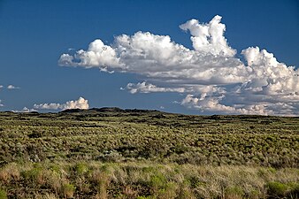
The Jornada del Muerto Volcano is a small shield volcano and lava field in central New Mexico, about 10 by 15 miles (16 by 24 km) in size and reaching an elevation of 5,136 feet (1,565 m). Jornada del Muerto means "Dead Man's Route" in Spanish,[2] referring to the desolate colonial era trail from New Spain through this Malpaís region.
Geography
The volcano and lava field is located at the northern end of the Jornada del Muerto Desert basin in the Basin and Range Province. The Jornada del Muerto basin runs between the Oscura Mountains and San Andres Mountains on the east, with the Caballo Mountains and the Fra Cristóbal Range on the west.
Geology
Volcano and cones
The main volcano vent is located slightly to the east of the center of the lava flows, rising about 150 feet (46 m) in a broad but conspicuous cone about a mile (1.6 km) in diameter. Within the outer cone are a series of nested spatter cones interspersed with lava pools. On the south side the innermost spatter cone rises to nearly 90 feet (27 m) above the surrounding lava pools, and surrounds an intact symmetrical crater 245 feet (75 m) across and about 30 feet (9 m) deep.
Volcanic field
The volcano erupted about 760,000 years ago in a series of basaltic flows. It produced a slow and viscous ʻaʻā lava volcanic field which has a very rough and uneven surface, making travel across it extremely difficult and hazardous; also time consuming. The total volume of erupted material is about 3 cubic miles (13 km3) and the lava fields cover an area of over 170 square miles (440 km2).
The largest individual flow-field extends from a center in extreme southeastern Socorro County and extends into Sierra County. Currently the flow forms the east bank of the Rio Grande from Fra Cristóbal north to Fort Craig, but at the time of eruption it temporarily dammed the Rio Grande.[3]
-
 View north to the malpaís lava field and a spatter cone
 -
 View south towards the nested splatter cones


See also
References
- ^ "Crater". NGS Data Sheet. National Geodetic Survey, National Oceanic and Atmospheric Administration, United States Department of Commerce. Retrieved 2014-02-12.
- ^ Crumpler, Larry. "Jornada del Muerto Volcano". New Mexico Museum of Natural History and Science. Archived from the original on 2014-02-22. Retrieved 2014-02-12.
- ^ Kottlowski, Frank E.; et al. (1956). Stratigraphic Studies of the San Andres Mountains, New Mexico. Socorro, NM: State Bureau of Mines and Mineral Resources, New Mexico Institute of Mining and Technology. OCLC 2206053.
Further reading
- Crumpler, L. S., and J. C. Aubele, (1990), Jornada del Muerto, New Mexico, in Volcanoes of North America, C. A. Wood and J. Kienle. eds., Cambridge University Press, Cambridge, p. 309-310.
- "Volcanoes of New Mexico: Jornada del Muerto Volcano". Archived from the original on September 27, 2007. Retrieved 2007-03-27.
External links
- "Jornada del Muerto". Geographic Names Information System. United States Geological Survey, United States Department of the Interior.
- v
- t
- e
- Black Mountain (Catron County)
- McKnight Mountain
- Cerro Grande
- Chicoma Mountain
- Redondo Peak
- South Baldy
- Pyramid Peak
(Cibola County)
- Mount Taylor
- West Blue Mountain
| Manzano Mountains | |
|---|---|
| Sandia Mountains |
| Cimarron Range |
|
|---|---|
| Taos Mountains |
|
| Others |
|
- Haystack Mountain
- Mount Sedgwick
- Aden Crater
- Alamo Hueco Mountains
- Animas Mountains
- Brazos Mountains
- Caballo Mountains
- Canjilón Mountain
- Canyon Creek Mountains
- Capitan Mountains
- Capulin Peak
- Cedar Mountain Range
- Datil Mountains
- Dirty Point
- Doña Ana Mountains
- Eagle Peak
- East Potrillo Mountains
- Elephant Butte (Hidalgo County)
- Elephant Butte (Sierra County)
- Fajada Butte
- Florida Mountains
- Franklin Mountains
- Granite Peak
- Guadalupe Mountains
- Guadalupe Mountains (Hidalgo County)
- Hosta Butte
- Hueco Mountains
- Huérfano Mountain
- Jicarilla Mountains
- Jornada del Muerto Volcano
- Ladron Peak
- Little Burro Mountains
- Little Hatchet Mountains
- Little San Pascual Mountain
- Luera Mountains
- Sierra Nacimiento
- Ocate Peak
- Ortiz Mountains
- Picacho Mountain
- Robledo Mountains
- San Antonio Mountain
- San Mateo Mountains (Socorro County)
- Sierra Aguilada
- Sierra Blanca
- Sierra de las Uvas
- West Potrillo Mountains


