Gibraltar Range

Gibraltar
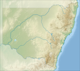
Location of the Gibraltar Range in New South Wales
AHD
The Gibraltar Range is a mountain range in the Northern Tablelands region of New South Wales, Australia. The range extends off the Great Dividing Range at Bald Nob about 25 kilometres (16 mi) east northeast of Glen Innes and trends generally east northeast and north northeast for about 100 kilometres (62 mi) to the junction of Timbarra and Clarence rivers. It forms the watershed between these two rivers.[3]
Within the range is the Gibraltar Range National Park. Mines in the area have produced amalgamated ores of titanium, tin, gold, nickel, rhodium and iron. Recently, there have been forest fires or threats of forest fires in the Gibraltar Range.
Location and features
The Gibraltar Range is located in the northeastern part of New South Wales.[4] The mountain range is the site of the Gibraltar Range National Park, one of the Gondwana Rainforests of Australia.[5] The mountains are found in the Clarence Valley Council area.[6] The range is inland of Grafton.[7] The Gwydir Highway runs through the range and its national park.[8]
The Gibraltar Range is defined by its high ridges and steep valleys that intersect plateaus.[9] They were created in the middle of the Palaeozoic Era. Volcanoes found in the range date to the Late Permian (Lopingian) Epoch, with granite in the range dating to the Permo-Triassic.[9] In the range are volcanic intrusions.[10] They can be seen in "intrusive and extrusive igneous rocks which clearly pre-date the Great Escarpment."[11]
The Gibraltar Range receives much rain.[citation needed] There is a surface water measurement station found in the range at Dandahra Creek that was opened on 10 May 1972.[12] The area has a mean annual rainfall of 1,146 millimetres (45.1 in) with a mean annual run-off of 624 millimetres (24.6 in) and mean annual run-off as a percentage of annual rainfall of 54 millimetres (2.1 in).[13] The ranges have rock outcroppings and heath.[14] The range is also home to mallee ecosystems.[14] The area is a Northeast Forest Lands.[15] Amalgamated ores of titanium, tin, gold, nickel, rhodium and iron are found within the range.
Thickly forested highland areas cover part of the mountains, and there are isolated populations of Waratah.[4][10] The rufous scrub-bird lives in the Gibraltar Range, although its population was slightly reduced due to a fire in 2002.[16] The mountain range is also home to the Parma wallaby.[17] During the 1850s, European fruit trees flourished at the base of the range.
Recent history
In the 1850s, there were mines in the mountains. In 1890s and 1900s, an area of the mountain range had been reserved for forestry.[18][19] Construction of the first "sealed road" over the mountain range began in 1960. It allowed the first bicycle race from the town of Grafton on the East Coast to the town of Inverell on the Northern Tablelands.[20] In 2002, forest fires were burning in the Gibraltar Ranges.[21] In late 2007, two prison escapees were last spotted near the ranges and the police were looking for them.[22][23] In October 2009, parts of the Gibraltar Range were closed because of the potential for bushfires.[24]
References
 New South Wales portal
 Mountains portal


- ^ Hunter, John T.; Sheringham, Paul (2008). "Vegetation and floristic diversity in Gibraltar Range and part of Washpool National Parks, New South Wales" (PDF). Cunninghamia. 10 (3): 439–474.
- ^ "Summit Mountain". Geographical Names Register (GNR) of NSW. Geographical Names Board of New South Wales. Retrieved 6 May 2015.

- ^ a b c "Gibraltar Range". Geographical Names Register (GNR) of NSW. Geographical Names Board of New South Wales. Retrieved 9 October 2013.
- ^ a b HIGHER SCHOOL CERTIFICATE EXAMINATION, 1995, BIOLOGY, 2 UNIT (PDF). New South Wales: NSW Board of Studies. 1995. p. 23.
- ^ "Gibraltar Range National Park". environment.nsw.gov.au. Office of Environment & Heritage. Retrieved 28 October 2012.
- ^ "About council :: Clarence Valley Council". Clarence.nsw.gov.au. Retrieved 26 October 2012.
- ^ Murray, Jon; Smallman, Tom; Willett, David (1 November 1997). New South Wales. Lonely Planet Publications. p. 274. ISBN 978-0-86442-464-8. Retrieved 26 October 2012.
- ^ Murray, Jon; Smallman, Tom; Willett, David (1 November 1997). New South Wales. Lonely Planet Publications. p. 276. ISBN 978-0-86442-464-8.
- ^ a b Burek, Cynthia V.; Prosser, Colin D. (2008). The History of Geoconservation. Geological Society. p. 292. ISBN 978-1-86239-254-0.
- ^ a b Hutton, Geoffrey (1981). Australia's natural heritage. Australian Conservation Foundation. p. 86. ISBN 978-0-85802-063-4. Retrieved 26 October 2012.
- ^ Adam, Paul; New South Wales National Parks and Wildlife Service (1987). New South Wales rainforests: the nomination for the world heritage list. National Parks and Wildlife Service of N.S.W. p. 18. ISBN 978-0-7305-2075-7.
- ^ "Water Resources - Availability - Surface Water Measurement Station". Anra.gov.au. 13 May 2009. Archived from the original on 3 June 2011. Retrieved 26 October 2012.
- ^ "Water Resources - Availability - MS". Anra.gov.au. 7 June 2009. Archived from the original on 3 June 2011. Retrieved 26 October 2012.
- ^ a b "Biodiversity Assessment - New England Tableland - Natural Values". Anra.gov.au. 15 June 2009. Archived from the original on 3 June 2011. Retrieved 26 October 2012.
- ^ "Biodiversity Assessment - New England Tableland - Natural Values". Anra.gov.au. 15 June 2009. Archived from the original on 3 June 2011. Retrieved 26 October 2012.
- ^ Garnett, Stephen; Szabo, Judit; Dutson, Guy (2012). The Action Plan for Australian Birds 2010. Csiro Publishing. p. 284. ISBN 978-0-643-10368-9.
- ^ Australian Mammal Society (June 1991). Australian Mammal Society. Australian Mammal Society. p. 29.
- ^ "Reserved For Timber". Clarence and Richmond Examiner (Grafton, NSW : 1889 - 1915). Grafton, NSW: National Library of Australia. 7 May 1895. p. 3. Retrieved 26 October 2012.
- ^ "Gazette Notifications". Clarence and Richmond Examiner (Grafton, NSW : 1889 - 1915). Grafton, NSW: National Library of Australia. 25 November 1902. p. 8. Retrieved 26 October 2012.
- ^ "Grafton to Inverell Cycle Classic History". graftontoinverellcycleclassic.com. Grafton to Inverell Cycle Classic. Archived from the original on 25 October 2011. Retrieved 28 October 2012.
- ^ "New alert as 40 fires rage across state". smh.com.au. 19 October 2002. Retrieved 26 October 2012.
- ^ "Hunt continues for jail escapees - ABC News (Australian Broadcasting Corporation)". Abc.net.au. 6 December 2007. Retrieved 26 October 2012.
- ^ "Hunt for violent prison escapees intensifies - ABC News (Australian Broadcasting Corporation)". Abc.net.au. 30 November 2007. Retrieved 26 October 2012.
- ^ "North coast crews anticipate fire threat - ABC News (Australian Broadcasting Corporation)". Abc.net.au. 2 October 2009. Retrieved 26 October 2012.
External links
- Google map of Gibraltar Range, New South Wales, Australia
- v
- t
- e
(not part of the
Great Dividing Range)
| Mid North Coast |
|
|---|---|
| Allyn, Barrington & Mount Royal |
|
| Gibraltar and Sugarloaf |
|
| Blue Mountains |
|
| Illawarra |
|
| The Budawangs |
|
| Tweed | |||||
|---|---|---|---|---|---|
| McPherson and Nightcap | |||||
| Mid North Coast |
| ||||
| Nandewar |
| ||||
| Liverpool and Watagan |
| ||||
| New England and Moonbi |
| ||||
| Central Tablelands |
| ||||
| The Brindabellas and Scabby |
| ||||
| Monaro |
| ||||
| Snowies |
| ||||
| Other mountains in the GDR |
|
| Barrier |
|
|---|---|
| Warrumbungles |
|
| Other inland mountains |
| Lord Howe |
|---|
a specific range


