Chucalissa
United States historic place
Chucalissa Site | |
U.S. National Historic Landmark | |
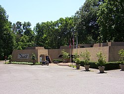 C.H. Nash Museum at Chucalissa (2009) | |
35°3′45″N 90°7′44″W / 35.06250°N 90.12889°W / 35.06250; -90.12889 | |
| Area | 160 acres (65 ha)[1] |
|---|---|
| NRHP reference No. | 73001830 |
| Significant dates | |
| Added to NRHP | May 7, 1973[2] |
| Designated NHL | April 19, 1994[3] |
The C.H. Nash Museum at Chucalissa is located on and exhibits excavated materials of the Mississippian culture archaeological site known as Chucalissa (40 SY 1) which means "abandoned house" in Chickasaw. The site is located adjacent to the T. O. Fuller State Park within the city of Memphis, Tennessee, United States. Chucalissa was designated National Historic Landmark in 1994 due to its importance as one of the best-preserved and major prehistoric settlement sites in the region.[1]
Description

Chucalissa is a Walls phase mound and plaza complex that was occupied, abandoned and reoccupied several times throughout its history, spanning from 1000 to 1550 CE. It is located on a bluff overlooking the Mississippi River. Other contemporaneous groups in the area include the Parkin phase, Menard phase, and the Nodena phase. It is known for the well preserved architectural, floral, faunal, and human osteological remains excavated there. During the early 1540s the Hernando de Soto Expedition passed through the area, stopping at many villages along the way. It is thought that the Walls phase may be the Province of Quizquiz encountered by de Soto on the banks of the Mississippi River. There is no evidence that Chucalissa itself was visited by the expedition, as it is thought to have been abandoned at the time.[4]
C. H. Nash Museum at Chucalissa
Civilian Conservation Corps workers discovered Native American artifacts on the site in 1938 and archaeological excavations of this Mississippian mound complex were initiated. The C. H. Nash Museum at Chucalissa and the rest of the village grounds have been operated by the University of Memphis since 1962.[5]
In 1973 Chucalissa Indian Village was added to the National Register of Historic Places.[2] Later, in 1994, it was declared a National Historic Landmark.[1][3] The archaeological site and grounds are managed by the C. H. Nash Museum at Chucalissa staff and students. The museum, named after its founding director, curates an extensive collection of artifacts recovered during a 40-year period of systematic excavations. The site features a Mississippian mound complex, nature trail and arboretum, hands-on archaeology lab, and exhibits that explore the history and life-ways of Native Americans of the historic and prehistoric southeastern United States.
See also
- Mississippian culture
- Parkin Archeological State Park
- Nodena site
- List of museums in Tennessee
- List of National Historic Landmarks in Tennessee
- National Register of Historic Places listings in Shelby County, Tennessee
References
Wikimedia Commons has media related to Chucalissa Museum and Archaeological site.
- ^ a b c Gerald P. Smith; Charles McNutt; Mark R. Barnes (January 29, 1993), National Register of Historic Places Inventory-Nomination: Chucalissa Site / 40SY1 (PDF), National Park Service, retrieved June 22, 2009 and Accompanying eight photos, aerial, site, and artifacts, from 1970, 1980, 1987, 1990, and undated (1.02 MB)
- ^ a b "National Register Information System". National Register of Historic Places. National Park Service. January 23, 2007.
- ^ a b "Chucalissa Site". National Historic Landmark summary listing. National Park Service. Archived from the original on June 6, 2008. Retrieved June 29, 2008.
- ^ Charles H. McNutt, ed. (1996). Prehistory of the Central Mississippi Valley. University of Alabama Press. pp. 241–253.
- ^ C. H. Nash Museum at Chucalissa website, accessed August 2009
External links
- C. H. Nash Museum at Chucalissa website, University of Memphis
- v
- t
- e
- List of Mississippian sites
- Timeline of Mississippi valley
Mississippian
| American Bottom and Upper Mississippi | |
|---|---|
| Lower Ohio River and Confluence area | |
| Middle Ohio River | |
| Tennessee and Cumberland | |
| Central and Lower Mississippi |
|
Mississippian
- Adamson
- Avery
- Beaverdam Creek
- Bell Field Mound
- Bessemer
- Biltmore
- Blair
- Bussell Island
- Chauga
- Chiaha
- Chota
- Citico
- Coosa
- Dallas phase
- Dyar
- Etowah
- Garden Creek
- Hoojah Branch
- Irene
- Jere Shine
- Joara
- Joe Bell
- King
- Lamar
- Lamar phase
- Liddell
- Little Egypt
- Long Swamp
- Mabila
- Mandeville
- McMahan
- Moccasin Bend
- Moundville
- Mouse Creek phase
- Mulberry
- Muscogee (Creek)
- Nacoochee
- Nikwasi
- Ocmulgee
- Park Mound
- Pisgah phase
- Punk Rock Shelter
- Rembert
- Roods Landing
- Rucker's Bottom
- Savannah
- Shiloh
- Sixtoe
- Summerour
- Taskigi
- Tomotley
- Toqua
- Town Creek
- Waddells Mill Pond
- Wilbanks
Mississippian
Mississippian
cultures
| Oneota | |
|---|---|
| Fort Ancient culture |
| Agriculture |
|
|---|---|
| Artwork | |
| Languages | |
| Religion |
- Related topics
- Chevron bead
- Clarksdale bell
- Mound Builders
- de Soto Expedition

| |
|---|---|
| Topics | |
| Lists by state |
|
| Lists by insular areas | |
| Lists by associated state | |
| Other areas | |
| Related | |
| |


