Bugaba District
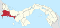
District in Chiriquí Province, Panama
8°28′48″N 82°37′12″W / 8.48000°N 82.62000°W / 8.48000; -82.62000 Panama
 (2000)
Bugaba District (Spanish pronunciation: [ˈbuɣaβa]) is a district (distrito) of Chiriquí Province in Panama. The population according to the 2000 census was 68,570.[1] The district covers a total area of 884 km². The capital lies at the city of La Concepción.[1]
Administrative divisions
Bugaba District is divided administratively into the following corregimientos:
- La Concepción (capital)
- Aserrío de Gariché
- Bugaba
- Gómez
- La Estrella
- San Andrés
- Santa Marta
- Santa Rosa
- Santo Domingo
- Solano
- Sortová
- El Bongo
References
- ^ a b "Districts of Panama". Statoids. Retrieved April 10, 2009.
- v
- t
- e

Capital: David
| |
|---|---|
| Bocas del Toro Province | |
| Chiriquí Province | |
| Coclé Province | |
| Colón Province | |
| Darién Province | |
| Herrera Province | |
| Los Santos Province | |
| Panamá Province | |
| Veraguas Province | |
| West Panamá Province | |
This article about the geography of Chiriquí Province is a stub. You can help Wikipedia by expanding it. |
- v
- t
- e


