Bayo, Nigeria
LGA in Borno State, Nigeria
10°16′22″N 11°39′41″E / 10.2729°N 11.6613°E / 10.2729; 11.6613 Nigeria
 (2006)

Bayo is a Local Government Area of Borno State, Nigeria. Its headquarters are in the town Fikayel.[1]
It has an area of 956 km2 and a population of 78,978 at the 2006 census.
The postal code of the area is 603.[2]
It is one of the four LGAs that constitute the Biu Emirate, a traditional state located in Borno State, Nigeria.[3]
References
- ^ "Governor Zulum, we need more secondary schools in Bayo LGA". Daily Trust. 2021-08-09. Retrieved 2022-11-19.
- ^ "Post Offices- with map of LGA". NIPOST. Archived from the original on 7 October 2009. Retrieved 2009-10-20.
- ^ Nigeria (2000). Nigeria: a people united, a future assured. Vol. 2, State Surveys (Millennium ed.). Abuja, Nigeria: Federal Ministry of Information. p. 106. ISBN 9780104089.
- v
- t
- e
Borno State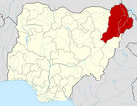
 | This Borno State, Nigeria location article is a stub. You can help Wikipedia by expanding it. |
- v
- t
- e


